Category:Bridges: Difference between revisions
mNo edit summary |
|||
| (14 intermediate revisions by the same user not shown) | |||
| Line 2: | Line 2: | ||
{{IRL header estuary}} | {{IRL header estuary}} | ||
<div class="irlcontenttop"> | <div class="irlcontenttop"> | ||
==Definition== | ==Causeway Definition== | ||
Florida has thousands of bridges and causeways. Many people use the words interchangeably. | Florida has thousands of bridges and causeways. Many people use the words interchangeably. | ||
So what is the difference between a bridge, a causeway and a causeway bridge?<ref name=TCPalmbridges /> | So what is the difference between a bridge, a causeway and a causeway bridge?<ref name=TCPalmbridges /> | ||
| Line 13: | Line 13: | ||
{{#evu:https://www.youtube.com/watch?v=HbOjs-HPgKk|dimensions=inherit|alignment=left}} | {{#evu:https://www.youtube.com/watch?v=HbOjs-HPgKk|dimensions=inherit|alignment=left}} | ||
</div> | </div> | ||
<div class="irlcontentmiddle"> | <div class="irlcontentmiddle"> | ||
==Earthen Berm Causeways== | ==Earthen Berm Causeways== | ||
Many early Indian River Lagoon bridges used earthen berm causeways to transverse most of the distance across a waterway. Swing, draw, or high span bridges were then installed over the waterway's main channel to allow tall watercraft to pass through. This construction technique, first used in medieval times to cross flooded peat bogs, amounts to blocking the entire waterway with an earthen dam and leaving a small opening for water to flow through. | |||
Indian River Lagoon causeways impede the flow of water bodies driven only by wind and minor tidal influence. They divide the lagoons into individual compartments, impede the exchange of water, disrupt the migration of marine life, and cause long water residence times that often hold pollutants for over 220 days. Causeway construction causes pockets of nutrient rich, decaying matter ({{Define|detritus}}) to pile up in the corners; trapping and feeding the IRL's seasonal algae blooms. | |||
The following | The following tables display the estimated* distance across the waterway (Causeway Length), open waterway (Bridge Length), and a constriction ratio (Bridge/Causeway) for each Indian River lagoon causeway. | ||
{| class="wikitable" | {| class="mw-collapsible wikitable" | ||
|+North Indian River Lagoon Causeways | |+ style=white-space:nowrap | North Indian River Lagoon Causeways | ||
!Name | !Name | ||
!Causeway | !Causeway | ||
| Line 95: | Line 33: | ||
|83% | |83% | ||
|- | |- | ||
|Max Brewer Bridge (SR406) | |[[Info:Max_Brewer_Bridge|Max Brewer Bridge (SR406)]] | ||
|6,600' | |6,600' | ||
| 1,686' | | 1,686' | ||
|74% | |74% | ||
|- | |- | ||
|NASA | |[[Info:NASA_Causeway_Indian_River|NASA Indian River (SR405)]] | ||
|15,840' | |15,840' | ||
|2,900' | |2,900' | ||
| Line 114: | Line 52: | ||
|1,430' | |1,430' | ||
|73% | |73% | ||
|- | |||
|[[Info:Pineda_Causeway|Pineda Causeway IRL (SR404)]] | |||
|7,075' | |||
|2,360' | |||
|67% | |||
|- | |||
|[[Info:Eau_Gallie_Causeway|Eau Gallie Causeway (SR518)]] | |||
|8,078' | |||
|3,479' | |||
|57% | |||
|- | |||
|Melbourne Causeway (US192) | |||
|8,765' | |||
|2,874' | |||
|67% | |||
|} | |} | ||
{| class="wikitable" | {| class="mw-collapsible wikitable" | ||
|+Banana River Causeways | |+ style=white-space:nowrap | Banana River Causeways | ||
!Name | !Name | ||
!Causeway | !Causeway | ||
| Line 127: | Line 80: | ||
| 100% | | 100% | ||
|- | |- | ||
|NASA | |NASA Banana River Bridge | ||
|13,464' | |13,464' | ||
|640' | |640' | ||
| Line 146: | Line 99: | ||
|625' | |625' | ||
|94% | |94% | ||
|- | |||
|[[Info:Pineda_Causeway|Pineda Causeway BRL (SR404)]] | |||
|7445' | |||
|1278' | |||
|83% | |||
|} | |} | ||
*These measurements were estimated using Google Map measure, may differ from measurements in the National Bridge Data Table, and should not be used for official documentation. Causeways are listed from North to South. | *These measurements were estimated using Google Map measure, may differ from measurements in the National Bridge Data Table, and should not be used for official documentation. Causeways are listed from North to South. | ||
</div> | |||
<div class="irlcontentmiddle"> | |||
==Causeway Bridge Map== | |||
Select a marker on the map to view Indian River Lagoon bridge and causeway information. | |||
{{#cargo_query: | |||
tables=bridge | |||
|fields= Name, CONCAT('[[File:',Image,'|300x180px|frameless|center|',Name,'|link=',_pageName,']]')=Image, Road, Water, City, County, FDOT, Description, _pageName=Link, Article, Coordinates | |||
|where= FDOT >= 1 | |||
|order by=FDOT | |||
|limit=20 | |||
|format=googlemaps | |||
|width=inherit | |||
|height=400px | |||
}} | |||
</div> | |||
<div class="irlcontentmiddle"> | |||
==Causeway Bridge Table== | |||
The '''Causeway Bridge Table''' displays the Indian River Lagoon bridge and causeway information available on this site. | |||
* An ''(info)'' link points to a page that displays the bridge's information box, plus any additional collected content. | |||
* An ''Article'' link points to a bridge's full page article. | |||
<div class="wikitable"> | |||
<div class="irlheaderright"><div class="irlheaderformbutton">[[Form:Bridge|Add Bridge]]</div></div> | |||
<div class="irltabletitle" style="text-align:left"><h3>Causeway Bridge Info</h3></div> | |||
<div class="irltabletext" style="text-align:left;margin-bottom:20px"> | |||
* Click '+' to show the description. | |||
* 'Toggle' additional columns | |||
* Click a column header to resort | |||
* Search by name, location, roadway, waterbody | |||
</div> | |||
{{#cargo_query: | |||
tables=bridge | |||
|fields= | |||
CONCAT( Name,' [[', _pageName,'|(info)]]')=Name, FDOT, Road, Water, City, County, Article, Description | |||
|order by=Name | |||
|rows per page=20 | |||
|format=dynamic table | |||
|hidden fields=FDOT, City, County, Article | |||
|details fields=Description | |||
}} | |||
</div></div> | |||
<div class="irlcontentmiddle"> | |||
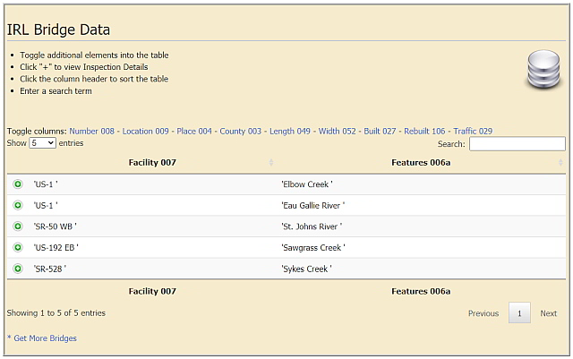
==Bridge Data== | |||
[[Bridge Data Table]] displays the United States National Bridge Inventory<ref name=NBIdata /> data for bridges in the six [[Indian River Lagoon Estuary|Indian River Lagoon National Estuary]] counties (Volusia, Brevard, Indian River, St. Lucie, Martin and Palm Beach). The data table includes information on over 1400 culvert, overpass and waterway bridges in the [[:Category:Water Body|Indian River Lagoon watershed]]. | |||
The bridge data table can be sorted by county, location, and roadway. It displays a bridge's physical data, construction detail, and inspection report. View [[Bridge Data Table]] for detailed information on Indian River Lagoon bridges. | |||
[[File:IRLN_screenshot_bridge_data_table.jpg|640px|frameless|left|alt=Bridge Data Table Screenshot|Bridge Data Table Screenshot|link=Bridge_Data_Table]] | |||
</div> | |||
<div class="irlcontentmiddle"> | |||
==Bridge List== | |||
[[Bridge_List]] is a manually updated list of waterway bridges in Mosquito, Banana River and Indian River lagoons. | |||
* Click expand to open the list. | |||
* Blue text links point to encyclopedia articles | |||
* (info) links point to info box pages. | |||
<div class="mw-collapsible mw-collapsed" style="margin-top:20px;width:340px; overflow:auto;"> | |||
<div class="irlcollapsetitle">Indian River Estuary Bridge List</div> | |||
<div class="mw-collapsible-content"> | |||
<div class="irlcollapsetext">Bridges and Causeways are listed from North to South.</div> | |||
<div>{{#section:Bridge List|irlestuarybridgelist}}</div></div></div> | |||
</div> | </div> | ||
<div class="irlcontentbottom"> | <div class="irlcontentbottom"> | ||
==Web Links== | ==Web Links== | ||
*[https://infobridge.fhwa.dot.gov/ FHWA - InfoBridge Data Explorer] | *[https://infobridge.fhwa.dot.gov/ FHWA - InfoBridge Data Explorer] | ||
Latest revision as of 06:34, November 23, 2021
Causeway Definition
Florida has thousands of bridges and causeways. Many people use the words interchangeably. So what is the difference between a bridge, a causeway and a causeway bridge?[1]
Bridge - a structure carrying a road, path, railroad, or canal across a river, ravine, road, railroad, or other obstacle.
Causeway - a raised road or track across low or wet ground.
Causeway Bridge - An earthen berm causeway with a bridge in the middle.
Earthen Berm Causeways
Many early Indian River Lagoon bridges used earthen berm causeways to transverse most of the distance across a waterway. Swing, draw, or high span bridges were then installed over the waterway's main channel to allow tall watercraft to pass through. This construction technique, first used in medieval times to cross flooded peat bogs, amounts to blocking the entire waterway with an earthen dam and leaving a small opening for water to flow through.
Indian River Lagoon causeways impede the flow of water bodies driven only by wind and minor tidal influence. They divide the lagoons into individual compartments, impede the exchange of water, disrupt the migration of marine life, and cause long water residence times that often hold pollutants for over 220 days. Causeway construction causes pockets of nutrient rich, decaying matter (detritus) to pile up in the corners; trapping and feeding the IRL's seasonal algae blooms.
The following tables display the estimated* distance across the waterway (Causeway Length), open waterway (Bridge Length), and a constriction ratio (Bridge/Causeway) for each Indian River lagoon causeway.
| Name | Causeway | Bridge | Constriction |
|---|---|---|---|
| NASA Railroad Bridge | 11,246' | 1,943' | 83% |
| Max Brewer Bridge (SR406) | 6,600' | 1,686' | 74% |
| NASA Indian River (SR405) | 15,840' | 2,900' | 82% |
| Beachline Indian River (SR528) | 8,870' | 2,380' | 73% |
| Merritt Island Causeway (SR520) | 5,280' | 1,430' | 73% |
| Pineda Causeway IRL (SR404) | 7,075' | 2,360' | 67% |
| Eau Gallie Causeway (SR518) | 8,078' | 3,479' | 57% |
| Melbourne Causeway (US192) | 8,765' | 2,874' | 67% |
| Name | Causeway | Bridge | Constriction |
|---|---|---|---|
| NASA Saturn Causeway | 13,200' | 0 | 100% |
| NASA Banana River Bridge | 13,464' | 640' | 96% |
| Beachline Banana River (SR528) | 7,075' | 1,189' | 83% |
| Sykes Creek Causeway (SR520) | 3,802' | 333' | 92% |
| Cocoa Beach Causeway (SR520) | 14,942' | 625' | 94% |
| Pineda Causeway BRL (SR404) | 7445' | 1278' | 83% |
*These measurements were estimated using Google Map measure, may differ from measurements in the National Bridge Data Table, and should not be used for official documentation. Causeways are listed from North to South.
Causeway Bridge Map
Select a marker on the map to view Indian River Lagoon bridge and causeway information.
Causeway Bridge Table
The Causeway Bridge Table displays the Indian River Lagoon bridge and causeway information available on this site.
- An (info) link points to a page that displays the bridge's information box, plus any additional collected content.
- An Article link points to a bridge's full page article.
Causeway Bridge Info
- Click '+' to show the description.
- 'Toggle' additional columns
- Click a column header to resort
- Search by name, location, roadway, waterbody
| Name | FDOT | Road | Water | City | County | Article | |
|---|---|---|---|---|---|---|---|
| Name | FDOT | Road | Water | City | County | Article | |
| Alma Lee Loy Bridge (info) | 880077 | CR656 | Central Indian River | Vero Beach | Indian River | ||
| Canaveral Locks Bridge (info) | 700117 | SR401 | Banana River | Cape Canaveral | Brevard | Canaveral Locks Bridge | |
| Eau Gallie Causeway (info) | 700184 | SR518 | North Indian River | Melbourne | Brevard | ||
| Ernest Lyons Bridge (info) | 890158 | A1A | South Indian River | Sewell's Point | Martin | ||
| Haulover Canal Bridge (info) | 703004 | SR3 | Mosquito Lagoon | Allenhurst | Brevard | Haulover Canal | |
| Mathers Bridge (info) | 704063 | SR3 | Banana River | Indian Harbour Beach | Brevard | Mathers Bridge Historic Engineering Record | |
| Max Brewer Bridge (info) | 700227 | SR406 | North Indian River | Titusville | Brevard | Max Brewer Bridge | |
| Merrill Barber Bridge (info) | 880087 | SR60 | Central Indian River | Vero Beach | Indian River | Merrill Barber Bridge | |
| NASA Causeway Indian River (info) | 703001 | SR405 | North Indian River | Titusville | Brevard | ||
| Pineda Causeway (info) | 700143 | SR404 | North Indian River | Melbourne | Brevard | ||
| Roosevelt Bridge (info) | 890151 | US1 | Saint Lucie River | Stuart | Martin | ||
| Sebastian Inlet Bridge (info) | 880005 | A1A | Central Indian River | Indian River Oaks | Brevard | Sebastian Inlet | |
| Wabasso Bridge (info) | 880051, 880053 | SR510 | Central Indian River | Wabasso | Indian River | Wabasso Bridge |
Bridge Data
Bridge Data Table displays the United States National Bridge Inventory[2] data for bridges in the six Indian River Lagoon National Estuary counties (Volusia, Brevard, Indian River, St. Lucie, Martin and Palm Beach). The data table includes information on over 1400 culvert, overpass and waterway bridges in the Indian River Lagoon watershed.
The bridge data table can be sorted by county, location, and roadway. It displays a bridge's physical data, construction detail, and inspection report. View Bridge Data Table for detailed information on Indian River Lagoon bridges.
Bridge List
Bridge_List is a manually updated list of waterway bridges in Mosquito, Banana River and Indian River lagoons.
- Click expand to open the list.
- Blue text links point to encyclopedia articles
- (info) links point to info box pages.
Halifax River Bridges
Volusia County
- Granada Bridge SR40
- Seabreeze Bridge SR430
- Main Street Bridge
- Broadway Bridge
- Veterans Memorial Bridge CR4050
- Port Orange Causeway USA1A
Mosquito Lagoon Bridges
Volusia County
- South Causeway SR44
Mosquito Lagoon Bridges
Brevard County
- Haulover Canal Bridge CR3 (info)
Banana River Bridges
Brevard County
- Kennedy Parkway Bridge CR3
- Saturn Causeway
- NASA Parkway Causeway SR405
- Beachline Causeway SR528
- Canaveral Locks Bridge SR401 (info)
- Hubert Humphrey Bridge SR520
- Pineda Causeway SR404 (info)
- Mathers Bridge CR3 (info)
Indian River Bridges
Brevard County
- NASA Railroad Bridge
- A. Max Brewer Memorial Parkway SR406 (info)
- NASA Parkway Causeway SR405 (info)
- Beachline Causeway SR528
- Hubert Humphrey Bridge SR520
- Pineda Causeway SR404 (info)
- Eau Gallie Causeway SR518 (info)
- Melbourne Causeway US192
- Sebastian Inlet Bridge A1A (info)
Indian River County
- Wabasso Causeway SR510 (info)
- Merrill P. Barber Bridge (info)
- Alma Lee Loy Bridge SR656 (info)
St. Lucie County
- North Causeway USA1A
- Seaway Drive Causeway USA1A
Martin County
- Frank Wacha Bridge CR732
- Ocean Blvd Causeway
- Ernest Lyons Bridge A1A (info)
- Evans Crary Bridge A1A - St.Lucie River
- Roosevelt Bridge US1 - St. Lucie River (info)
- SE Bridge Rd. Causeway CR707
Palm Beach County
- South Beach Road Causeway CR707
Web Links
Documents
References
- ↑ TCPalm You Tube Channel
- ↑ National Bridge Inventory, retrieved 11/15/2020.
Subcategories
This category has the following 5 subcategories, out of 5 total.
B
- Banana River Bridges (4 P)
H
- Halifax River Bridges (empty)
I
M
- Mosquito Lagoon Bridges (1 P)
S
- Saint Lucie River Bridges (1 P)
Pages in category "Bridges"
The following 2 pages are in this category, out of 2 total.