[{"name":"Banana River","title":"Banana River","lat":28.44857999999999975671016727574169635772705078125,"lon":-80.625439999999997553459252230823040008544921875,"otherValues":{"Image":"\u003Cfigure class=\"mw-halign-center\" typeof=\"mw:File\/Frameless\"\u003E\u003Ca href=\"\/guide\/index.php\/Category:Banana_River_Water_Body\" title=\"Banana River\"\u003E\u003Cimg alt=\"Banana River\" src=\"\/guide\/images\/thumb\/0\/0b\/Banana_River_001.jpg\/269px-Banana_River_001.jpg\" decoding=\"async\" width=\"269\" height=\"180\" class=\"mw-file-element\" srcset=\"\/guide\/images\/thumb\/0\/0b\/Banana_River_001.jpg\/403px-Banana_River_001.jpg 1.5x, \/guide\/images\/thumb\/0\/0b\/Banana_River_001.jpg\/538px-Banana_River_001.jpg 2x\" data-file-width=\"639\" data-file-height=\"428\" \/\u003E\u003C\/a\u003E\u003Cfigcaption\u003EBanana River\u003C\/figcaption\u003E\u003C\/figure\u003E","Type":"Lagoon","Basin":"Banana River","County":"Brevard","Description":"Lying entirely within Brevard County, 31 mile long, 30,000 acre Banana River is the smallest lagoon basin in the Indian River Lagoon National Estuary.","Article":"\u003Ca href=\"\/guide\/index.php\/Banana_River\" title=\"Banana River\"\u003EBanana River\u003C\/a\u003E"}},{"name":"Halifax River","title":"Halifax River","lat":29.2582799999999991769072948954999446868896484375,"lon":-81.0373299999999971987563185393810272216796875,"otherValues":{"Image":"\u003Cfigure class=\"mw-halign-center\" typeof=\"mw:File\/Frameless\"\u003E\u003Ca href=\"\/guide\/index.php\/Category:Halifax_River_Water_Body\" title=\"Halifax River\"\u003E\u003Cimg alt=\"Halifax River\" src=\"\/guide\/images\/thumb\/c\/cb\/Waterbody_halifax_river.jpg\/240px-Waterbody_halifax_river.jpg\" decoding=\"async\" width=\"240\" height=\"180\" class=\"mw-file-element\" srcset=\"\/guide\/images\/thumb\/c\/cb\/Waterbody_halifax_river.jpg\/360px-Waterbody_halifax_river.jpg 1.5x, \/guide\/images\/thumb\/c\/cb\/Waterbody_halifax_river.jpg\/480px-Waterbody_halifax_river.jpg 2x\" data-file-width=\"800\" data-file-height=\"600\" \/\u003E\u003C\/a\u003E\u003Cfigcaption\u003EHalifax River\u003C\/figcaption\u003E\u003C\/figure\u003E","Type":"Lagoon","Basin":"Halifax River","County":"Volusia","Description":"Volusia County's Halifax River was added to the IRL National Estuary in 2016. The 25 mile addition includes Bulow Creek, Tomoka River, and southward to Ponce de Leon Inlet.","Article":"\u003Ca href=\"\/guide\/index.php\/Halifax_River\" title=\"Halifax River\"\u003EHalifax River\u003C\/a\u003E"}},{"name":"Indian River","title":"Indian River","lat":28.153369999999998896100805723108351230621337890625,"lon":-80.62511000000000649379217065870761871337890625,"otherValues":{"Image":"\u003Cfigure class=\"mw-halign-center\" typeof=\"mw:File\/Frameless\"\u003E\u003Ca href=\"\/guide\/index.php\/Category:Indian_River_Water_Body\" title=\"Indian River\"\u003E\u003Cimg alt=\"Indian River\" src=\"\/guide\/images\/thumb\/3\/3f\/Indian_River_Lagoon_Sunrise_MLB.jpg\/288px-Indian_River_Lagoon_Sunrise_MLB.jpg\" decoding=\"async\" width=\"288\" height=\"180\" class=\"mw-file-element\" srcset=\"\/guide\/images\/thumb\/3\/3f\/Indian_River_Lagoon_Sunrise_MLB.jpg\/432px-Indian_River_Lagoon_Sunrise_MLB.jpg 1.5x, \/guide\/images\/thumb\/3\/3f\/Indian_River_Lagoon_Sunrise_MLB.jpg\/576px-Indian_River_Lagoon_Sunrise_MLB.jpg 2x\" data-file-width=\"640\" data-file-height=\"400\" \/\u003E\u003C\/a\u003E\u003Cfigcaption\u003EIndian River\u003C\/figcaption\u003E\u003C\/figure\u003E","Type":"Lagoon","Basin":"Indian River","County":"Brevard","Description":"Indian River (\u003Ci\u003ERio de Ais\u003C\/i\u003E) is a 121 mile long lagoon spanning five counties on Florida's East Coast. From it's northern boundary in Brevard County, the lagoon ranges south through Indian River, St. Lucie and Martin, to it's southern boundary at Jupiter Inlet in Palm Beach County. Indian River is the largest lagoon basin in the Indian River Lagoon National Estuary.","Article":"\u003Ca href=\"\/guide\/index.php\/Indian_River\" title=\"Indian River\"\u003EIndian River\u003C\/a\u003E"}},{"name":"Mosquito Lagoon","title":"Mosquito Lagoon","lat":28.83655999999999863803168409503996372222900390625,"lon":-80.794129999999995561665855348110198974609375,"otherValues":{"Image":"\u003Cfigure class=\"mw-halign-center\" typeof=\"mw:File\/Frameless\"\u003E\u003Ca href=\"\/guide\/index.php\/Category:Mosquito_Lagoon_Water_Body\" title=\"Mosquito Lagoon\"\u003E\u003Cimg alt=\"Mosquito Lagoon\" src=\"\/guide\/images\/thumb\/e\/ec\/Mosquito_Lagoon_001.jpg\/240px-Mosquito_Lagoon_001.jpg\" decoding=\"async\" width=\"240\" height=\"180\" class=\"mw-file-element\" srcset=\"\/guide\/images\/thumb\/e\/ec\/Mosquito_Lagoon_001.jpg\/360px-Mosquito_Lagoon_001.jpg 1.5x, \/guide\/images\/e\/ec\/Mosquito_Lagoon_001.jpg 2x\" data-file-width=\"480\" data-file-height=\"360\" \/\u003E\u003C\/a\u003E\u003Cfigcaption\u003EMosquito Lagoon\u003C\/figcaption\u003E\u003C\/figure\u003E","Type":"Lagoon","Basin":"Mosquito Lagoon","County":"Volusia","Description":"Mosquito Lagoon (\u003Ci\u003ELos Mosquitos\u003C\/i\u003E) is a 28 mile long, 36,000 acre, brackish water lagoon bounded by Ponce de Leon Inlet, Merritt Island National Wildlife Refuge, Canaveral National Seashore and Kennedy Space Center (KSC).","Article":"\u003Ca href=\"\/guide\/index.php\/Mosquito_Lagoon\" title=\"Mosquito Lagoon\"\u003EMosquito Lagoon\u003C\/a\u003E"}}]
Volusia County's Halifax River was added to the IRL National Estuary in 2016. The 25 mile addition includes Bulow Creek, Tomoka River, and southward to Ponce de Leon Inlet. Halifax River Article
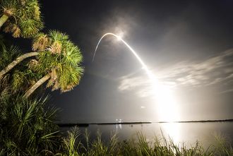
Mosquito Lagoon (Los Mosquitos) is a 28 mile long, 36,000 acre, brackish water lagoon bounded by Ponce de Leon Inlet, Merritt Island National Wildlife Refuge, Canaveral National Seashore and Kennedy Space Center (KSC). Mosquito Lagoon Article
Lying entirely within Brevard County, 31 mile long, 30,000 acre Banana River is the smallest lagoon basin in the Indian River Lagoon National Estuary. Banana River Article
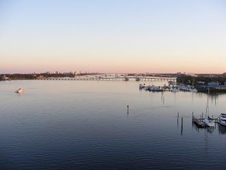
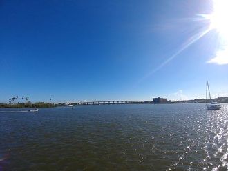
Indian River (Rio de Ais) is a 121 mile long lagoon spanning five counties on Florida's East Coast. From it's northern boundary in Brevard County, the lagoon ranges south through Indian River, St. Lucie and Martin, to it's southern boundary at Jupiter Inlet in Palm Beach County. Indian River is the largest lagoon basin in the Indian River Lagoon National Estuary. Indian River Article
*Normally a river's course is described in the direction of it's current flow. The Indian River Estuary doesn't have a directional flow, so this website will always describe it's Water Bodies in a north to south direction.
*Lagoons do not have a directional current and some water bodies (tidal marshes, canals and inlets) flow in both directions, so these water bodies are not technically tributaries. However, for this website's purposes, all connecting water bodies regardless of current, may be referred to as tributaries.