Info:NASA Causeway Indian River
From Indian River Lagoon Project
NASA Causeway Indian River
|
|
|
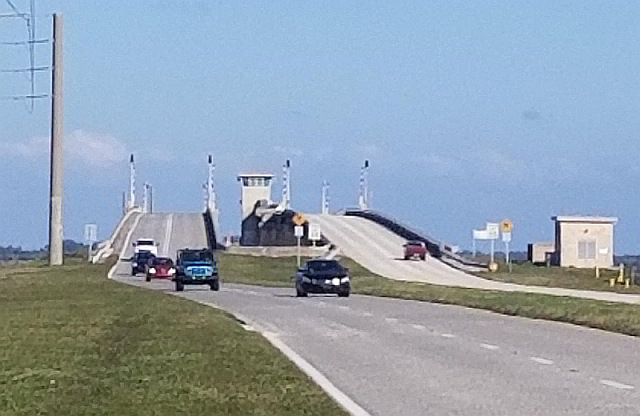
| Three mile long NASA Causeway connects SR405 in Titusville with Kennedy Space Center's NASA Parkway in Merritt Island, Florida. The causeway's 2,990ft bridge across the Indian River spans the Intracoastal Waterway (ICW) channel with a 142ft divided, four-lane, double-leaf bascule drawbridge. A new high span concrete bridge is due to begin construction in late 2021.
|
| Waterway: North Indian River
|
Road: SR405
|
| City: Titusville
|
County: Brevard
|
| Type: Bascule Drawbridge
|
Builder:McCormick and Sons
|
| DOT: 703001
|
L: 2993'
|
|
Built: 1964
|
Location: 28.5284, -80.76561
|
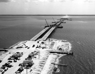
1964 NASA Parkway Causeway
Built in 1964, the NASA Causeway Bridge across the Indian River has
- reinforced concrete approaches
- aluminum handrails
- double-leaf bascule span
- and an estimated 12,940 feet of earthen berm causeway.
NASA Causeway's concrete bridge approaches are 1,460 x 28 feet long and the steel draw spans are 142.75 x 28 feet.
When the double-leaf span is open, the drawbridge provides an estimated 105ft of clearance to vessels in the Intracoastal Waterway channel.
The bridge has a three-story concrete control house that is 14.33 x 12.75 feet. The control house is capped by a metal and glass control room with a flat roof and walls that flare out from bottom to top.
Flow Factor
Our "Flow Factor" variable is an unscientific estimate of water flow constriction using Google Map Measurements.
Bridge Length / Lagoon Width = Flow Factor
2,900ft Bridge Length / 15,840ft Lagoon Width = 18.3% Flow Factor
18.3% of the lagoon's width is spanned by the bridge and not impeded by the earthen berm causeway.
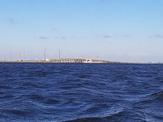
NASA Causeway impedes the Indian River's water flow for an estimated 12,940ft (2.45 miles) or 81.7% of the lagoon's three mile width.
National Bridge Inventory Data
NASA Parkway Causeway (SR405) spans the Indian River with two draw span bridges, NBI #703001 & 703002.
| Number
|
Road
|
Structure
|
Location
|
Water
|
| 703001
|
SR405
|
Main Span Westbound
|
Titusville
|
Indian River
|
National Bridge Data
| Number
|
703001
|
| Route
|
SR405
|
| Place
|
Titusville
|
| County
|
Brevard
|
| Features
|
INDIAN RIVER
|
| Facility
|
NASA CAUSEWAY WB
|
| Location
|
KENNEDY SPACE CENTER
|
| Latitude
|
28313884
|
| Longitude
|
80454983
|
| Service On Roadway
|
Highway
|
| Service Under Roadway
|
Waterway
|
| Owner
|
NASA
|
| Built
|
1964
|
| Rebuilt
|
|
| Lanes
|
2
|
| Lane Direction
|
2 way
|
| Direction
|
Westbound
|
| Traffic
|
6700
|
| Traffic Year
|
2016
|
| Future Traffic
|
|
| Future Traffic Year
|
|
| Length
|
912m
|
| Width
|
10m
|
| Clearance
|
|
| Kind
|
Steel
|
| Type
|
Movable - Bascule
|
| Deck Type
|
Concrete Cast-in-Place
|
| Critical
|
|
| Inspection Date (mm-yy)
|
08-17
|
| Deck
|
Satisfactory
|
| Superstructure
|
Fair
|
| Substructure
|
Fair
|
| Channel
|
Bank is beginning to slump. River control devices and embankment protection have widespread minor damage. There is minor stream bed movement evident. Debris is restricting the channel slightly.
|
| Culvert
|
|
| Scour
|
Bridge foundations determined to be stable for assessed or calculated scour condition. Scour is determined to be within the limits of footing or piles (Example B) by assessment (i.e.,bridge foundations are on rock formations that have been determined to resist scour within the service life of the bridge), by calculations or by installation of properly designed countermeasures
|
|
| Number
|
Road
|
Structure
|
Location
|
Water
|
| 703002
|
SR405
|
Main Span Eastbound
|
Titusville
|
Indian River
|
National Bridge Data
| Number
|
703002
|
| Route
|
SR405
|
| Place
|
Titusville
|
| County
|
Brevard
|
| Features
|
INDIAN RIVER
|
| Facility
|
NASA CAUSEWAY EB
|
| Location
|
KENNEDY SPACE CENTER
|
| Latitude
|
28313826
|
| Longitude
|
80454983
|
| Service On Roadway
|
Highway
|
| Service Under Roadway
|
Waterway
|
| Owner
|
NASA
|
| Built
|
1964
|
| Rebuilt
|
|
| Lanes
|
2
|
| Lane Direction
|
2 way
|
| Direction
|
Westbound
|
| Traffic
|
6500
|
| Traffic Year
|
2016
|
| Future Traffic
|
|
| Future Traffic Year
|
|
| Length
|
912m
|
| Width
|
10m
|
| Clearance
|
|
| Kind
|
Steel
|
| Type
|
Movable - Bascule
|
| Deck Type
|
Concrete Cast-in-Place
|
| Critical
|
|
| Inspection Date (mm-yy)
|
08-17
|
| Deck
|
Satisfactory
|
| Superstructure
|
Fair
|
| Substructure
|
Fair
|
| Channel
|
Bank is beginning to slump. River control devices and embankment protection have widespread minor damage. There is minor stream bed movement evident. Debris is restricting the channel slightly.
|
| Culvert
|
|
| Scour
|
Bridge foundations determined to be stable for assessed or calculated scour condition. Scour is determined to be within the limits of footing or piles (Example B) by assessment (i.e.,bridge foundations are on rock formations that have been determined to resist scour within the service life of the bridge), by calculations or by installation of properly designed countermeasures
|
|


