View table: weblink
From Indian River Lagoon Project
Table structure:
- Name - String
- Link_Url - URL
- Description - Text
- Region - String
- Type - String
- Topic - String
- Subtopic - List of Text, delimiter: ,
- Site_Logo - File
- Screenshot - File
- Coordinates - Coordinates
- Text_Body - Text
- Poster - String
- Posted - String
This table has 123 rows altogether.
| Page | Name | Link Url | Description | Region | Type | Topic | Subtopic | Site Logo | Screenshot | Coordinates | Text Body | Poster | Posted |
|---|---|---|---|---|---|---|---|---|---|---|---|---|---|
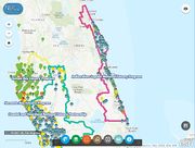
| Link:Algal Bloom Dashboard | Algal Bloom Dashboard | Florida Department of Environmental Protection (FDEP) Blue-Green Algal Bloom Dashboard displays the Florida algal bloom database on an interactive GIS map. The algal bloom dashboard includes the map, visual observations, monitoring, reporting and links to FDEP algal bloom information. Zoom into your Florida location to view reported algae blooms. | Florida | Dashboard | Research Resources | Educational Material • Water Quality Resources | Admin | 20211229074106 | |||||
| Link:An Afternoon in Mosquito Lagoon | An Afternoon in Mosquito Lagoon | Oysters in Mosquito Lagoon serve many important functions. They filter the water, are consumed by a variety of predators (including humans) and create habitat for over 100 species. Sadly, Mosquito Lagoon's oysters are in trouble. This story describes some of the amazing animals that live in or around Mosquito Lagoon's oyster reefs. Information on how everyone can help protect Mosquito Lagoon oysters is also explained. | Brevard County | Childrens Book | Education K-12 | Educational Material | Admin | 20191115075601 | |||||
| Link:An Overview of the Indian River Lagoon | An Overview of the Indian River Lagoon | "An Overview of the Indian River Lagoon (PDF 22pp 930KB)" is a paper written by Keri A. Smith from the University of Florida Soil and Water Science Department. This paper provides a concise overview of IRL history, habitat, species, health and restoration efforts. | Florida East Coast | Document | Restoration Resources | Educational Material | Admin | 20191130144846 | |||||
| Link:Banana River Lagoon Seagrass 1992-2019 Time Lapse Animation | Banana River Lagoon Seagrass 1992-2019 Time Lapse Animation | Banana River seagrass time lapse animation presented by Dr. Erich Marzolf at the St. Johns River Water Management District Governing Board meeting on January 12, 2021. | Brevard County | Video | Research Resources | Water Quality Resources | <div class="irlcontentmiddle"> '"`UNIQ--item-93--QINU`"' '"`UNIQ--item-94--QINU`"' '"`UNIQ--evlplayer-0000005F-QINU`"' </div> <div class="irlcontentmiddle"> View on YouTube: [https://www.youtube.com/watch?v=IxBACBJiEK0&t=10468 Banana River Lagoon Seagrass Time Lapse Animation 1992-2019] [https://www.youtube.com/watch?v=IxBACBJiEK0&t=10305 Indian River Lagoon Seagrass Mapping Presentation by Dr. Erich Marzolf] </div> | Admin | 20210113101349 | ||||
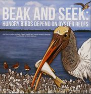
| Link:Beak and Seek | Beak and Seek | "Beak and seek : hungry birds depend on oysters reefs". Oyster Reefs and Birds are connected in many significant ways..Look inside these pages and you will learn about some of our favorite wading and aquatic birds - How they feed, what they eat, and why protecting our oyster reefs is essential to protecting these amazing birds! | Childrens Book | Education K-12 | Bird Watching | Admin | 20191115082741 | ||||||
| Link:Black Point Wildlife Drive | Black Point Wildlife Drive | The best place in the Merritt Island National Wildlife Refuge to see wildlife from your car is along the Black Point Wildlife Drive. The 7-mile, one-way drive follows a dike road around several shallow marsh impoundments and through pine flatwoods. BPWD provides an excellent place to see waterfowl, wading birds, shorebirds and raptors. Alligators, river otters, bobcats, various species of snakes, and other wildlife may be visible as well. A self-guiding brochure provides information on things to look for. Driving time is approximately 40 minutes. There is a $15 fee per vehicle for a refuge day pass. | Brevard County | Web Site | National Wildlife Refuges | Scenic Drive • Wildlife Encounter | 28.67112, -80.73771 | Admin | 20200508144846 | ||||
| Link:Canaveral National Seashore | Canaveral National Seashore | [[Canaveral National Seashore]] is a recreational paradise with [[Canaveral National Seashore/Backcountry Camping|back-country camping]], paddling, hiking, fishing, surfing, swimming and bird watching opportunities. The seashore's northern entrance is at Apollo Beach in Volusia's New Symyrna. The south entrance is at Playalinda Beach, east of Titusville in Brevard. The park is open from 6am to dusk. Vehicle Fee: $15.00. Motorcycle Fee: $10.00. Visit the [https://www.nps.gov/cana/ Canaveral National Seashore]] website for current news and information. | Brevard County | Web Site | National Parks | Beaches • Paddling • Primitive Camping • Inshore Fishing • Shore Fishing • Surf Fishing • Sightseeing • Wildlife Encounter • Sea Turtle Watching | Admin | 20191114135618 | |||||
| Link:Catch a Memory Outdoors - Indian River Lagoon Report Card (11-30-2019) | Catch a Memory Outdoors - Indian River Lagoon Report Card (11-30-2019) | Indian River Lagoon Report Card (11/30/2019) episode of the "Catch a Memory Outdoors" radio show with guest Dr. Leesa Souto from the Marine Resource Council and radio show host, fishing guide Jim Ross. * Website: http://catchamemoryoutdoors.com * Audio File: [http://archive.ncnradio.com/wwbc/wwbcout/2019/01242_OUTDOORS-2019-11-30.mp3 Indian River Lagoon Report Card (mp3)] | Brevard County | Radio Show | Fishing | Water Quality Resources | Admin | 20191201175740 | |||||
| Link:Catch a Memory Outdoors Radio Show | Catch a Memory Outdoors Radio Show | Podcast archive of WWBC-AM "Catch a Memory Outdoors" radio show hosted by Indian River estuary fishing guide Jim Ross. Weekly insight on the IRL's health condition. * Website: http://catchamemoryoutdoors.com/archives * Podcast Feed: [[File:Rss.png |48px|RSS Feed|link=http://ondemand.1510wwbc.com/rss.php?wr=wwbcout]] | Brevard County | Radio Show | Fishing | Admin | 20191201181403 | ||||||
| Link:Chuck Jacoby - Webinar - Where are you going Indian River Lagoon? | Chuck Jacoby - Webinar - Where are you going Indian River Lagoon? | Supervising Environmental Scientist Dr. Charles Jacoby discusses the work of the St. Johns River Water Management District to protect and restore the Indian River Lagoon in this webinar originally broadcast on Nov. 5, 2020. | Florida East Coast | YouTube Video | Water Quality Resources | Educational Material | Admin | 20201213171920 | |||||
| Link:Coast Guard Notice - NASA Causeway Project Plans | Coast Guard Notice - NASA Causeway Project Plans | June 16, 2020 US Coast Guard Public Notice and Project plans for the NASA Causeway Bridge (SR405) rebuild project. | Brevard County | Document | NASA - KSC | The project proposes replacing the existing SR-405 bascule bridge with a higher level fixed bridge, consisting of two, 12 ft. wide travel lanes in each direction with limited shoulders. The overall length of the bridge structure will be 4025 ft. long (abutment to abutment). The out-to-out width of the proposed high-level fixed bridge structure will be 121.-8 ft. The replacement bridge will be conducted in two phases. Phase one will construct the eastbound bridge. Once traffic has shifted to the eastbound bridge, the existing bascule bridge will be demolished and the westbound bridge constructed, causing no disruption to vehicular traffic. The Office of Environmental Management (OEM), as the lead federal agency through National Environmental Policy Act (NEPA) assignment has made a determination that the proposed project is a Categorical Exclusion (CATEX) for purposes of NEPA. The Coast Guard made a tentative determination the project qualifies as a CATEX because it satisfies criteria for such actions listed in the Coast Guard’s NEPA Implementing Instructions. The complete Public Notice 05-20 including: a summary of project impacts, and drawings of the location and plans for the proposed bridge can be viewed and printed at https://www.navcen.uscg.gov/pdf/bridges/publicNotices//D07PN05-20_NasaCausewayBridge_AtlanticIntercoastalWaterway.pdf | Admin | 20210218094441 | |||||
| Link:Conservation Conversations with Chelsea - Abbey Gering | Conservation Conversations with Chelsea - Abbey Gering | Soil & Water Conservation District Supervisor Chelsea Partridge interviews Abbey Gering, graduate student at the Florida Institute of Technology. Abbey has created an innovative way to help reduce nutrient in the Indian River Lagoon. | Brevard County | YouTube Video | Restoration Resources | Admin | 20210409172557 | ||||||
| Link:Conservation Conversations with Chelsea - Callie Shaffer | Conservation Conversations with Chelsea - Callie Shaffer | Soil & Water Conservation District Supervisor Chelsea Partridge interviews Callie Shaffer, the Conservation Outreach Coordinator for the Brevard Zoo's Restore Our Shores program. | Brevard County | YouTube Video | Conservation Resources | Restoration Resources | Admin | 20210515192332 | |||||
| Link:Conservation Conversations with Chelsea - Dr. Leesa Souto | Conservation Conversations with Chelsea - Dr. Leesa Souto | Soil & Water Conservation District Supervisor Chelsea Partridge interviews Dr. Leesa Souto, Executive Director of the Marine Resources Council | Brevard County | YouTube Video | Restoration Resources | Admin | 20210228153933 | ||||||
| Link:Continuous Water Quality Monitoring Portal | Continuous Water Quality Monitoring Portal | St. Johns River Water Management District’s (SJRWMD) Continuous Monitoring Web Portal allows you to view and download data collected from the district's water quality monitoring stations. | Florida East Coast | Dashboard | Water Quality Resources | <h2>Indian River Lagoon (IRL) Water Quality Dashboard</h2> *Stations by Parameter ([https://secure.sjrwmd.com/aqportal/Data/Dashboard/924 30 days] or [https://secure.sjrwmd.com/aqportal/Data/Dashboard/21 7 days]) *Parameters by Station **[https://secure.sjrwmd.com/aqportal/Data/Dashboard/22 Chlorophyll] **[https://secure.sjrwmd.com/aqportal/Data/Dashboard/22 Dissolved Oxygen] **[https://secure.sjrwmd.com/aqportal/Data/Dashboard/901 Relative Chlorophyll] **[https://secure.sjrwmd.com/aqportal/Data/Dashboard/901 Water Temperature] [[File:SJRWMD IRL Water Quality Station Map.jpg|alt=IRL Water Quality Station Map|none|thumb|526x526px|SJRWMD IRL Water Quality Station Map]] | Admin | 20210630081045 | |||||
| Link:Dr Douglass Science Network Facebook Page | Dr Douglass Science Network Facebook Page | Florida Gulf Coast University Marine Biology Professor Dr. James Douglass' public Facebook page, with stuff about marine biology, environmental conservation, etc. | Research Resources | Conservation Resources | Admin | 20210112105649 | |||||||
| Link:Dr. Douglass' Science Network | Dr. Douglass' Science Network | Public Facebook page for Dr. James G. Douglass, an ecologist interested in describing, protecting, and teaching about the biological diversity and beneficial ecosystem functions of coastal marine habitats. Coastal oceans are simultaneously threatened by decreasing water quality, changing physical conditions, and overharvest of ecologically important species. Dr. Douglass addresses the interactive effects of these threats through conservation-directed research and teaching at Florida Gulf Coast University. | Research Resources | Restoration Resources • Education College | Admin | 20191117205555 | |||||||
| Link:Dr. James Douglass Marine Ecologist Personal Blog | Dr. James Douglass Marine Ecologist Personal Blog | Personal Blog by Dr. James G. Douglass, an ecologist interested in describing, protecting, and teaching about the biological diversity and beneficial ecosystem functions of coastal marine habitats. Coastal oceans are simultaneously threatened by decreasing water quality, changing physical conditions, and overharvest of ecologically important species. * Read a November 11, 2019 excerpt concerning the health of seagrass in the IRL: [[Link:Dr._James_Douglass_Marine_Ecologist_Personal_Blog/CERF_Report_2019]] | Blog | Research Resources | Admin | 20191117212753 | |||||||
| Link:EBird Tracker | EBird Tracker | Bird Tracking Application for Mobile and Browser. Explore birds and hotspots near you and wherever you go, all based on the latest sightings from around the world. The data collected by eBird benefits research and conservation projects worldwide. *Find Birds *Report Sightings *Track reports by Locations | Application | Bird Watching | Research Resources | Admin | 20191119192912 | ||||||
| Link:Environmental Protection Agency | Environmental Protection Agency | The mission of EPA is to protect human health and the environment. | United States | Web Site | Government Organizations | Water Quality Resources • Research Institute | EPA works to ensure that: *Americans have clean air, land and water; *National efforts to reduce environmental risks are based on the best available scientific information; *Federal laws protecting human health and the environment are administered and enforced fairly, effectively and as Congress intended; *Environmental stewardship is integral to U.S. policies concerning natural resources, human health, economic growth, energy, transportation, agriculture, industry, and international trade, and these factors are similarly considered in establishing environmental policy; *All parts of society--communities, individuals, businesses, and state, local and tribal governments--have access to accurate information sufficient to effectively participate in managing human health and environmental risks; *Contaminated lands and toxic sites are cleaned up by potentially responsible parties and revitalized; and *Chemicals in the marketplace are reviewed for safety. | Admin | 20200409144849 | ||||
| Link:EPA Environmental Educational Materials for Teachers | EPA Environmental Educational Materials for Teachers | Order EPA educational materials for your classroom. All materials are offered free of charge. | United States | Web Site | Educational Material | Education K-12 | Admin | 20191116125211 | |||||
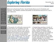
| Link:Exploring Florida Social Studies Resources | Exploring Florida Social Studies Resources | The web site "Exploring Florida: Social Studies Resources for Students and Teachers" contains thousands of educational resources for use in your classroom. | Florida | Web Site | Education K-12 | Educational Material • History Links | Admin | 20191119194810 | |||||
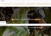
| Link:Fish and Wildlife Service Conservation Library | Fish and Wildlife Service Conservation Library | The USFWS Conservation Library is a searchable research knowledge base collecting information from WorldCat, Refworks, and Web of Science databases. | United States | Archive | Conservation Resources | Educational Material | Admin | 20201108143604 | |||||
| Link:Fish and Wildlife Service National Digital Library | Fish and Wildlife Service National Digital Library | The United States Fish and Wildlife Service's National Digital Library is an archive of images, videos, documents, audio, and maps. | United States | Archive | Educational Material | Wildlife | '''Videos''' The Videos collection depicts the outstanding work of our FWS videographers who have produced outreach and instructional tools available for public access and depicts the outstanding work of the U.S. Fish and Wildlife Service and its conservation partners. '''Documents''' The Documents collection is a selection of reports, brochures, historic texts, oral history transcripts, and other texts. '''Audio''' The Audio collection is a selection of podcasts and audio files that provide insight into the U.S. Fish and Wildlife Service mission - "working with others to conserve, protect and enhance fish, wildlife, and plants and their habitats for the continuing benefit of the American people". '''Maps''' The Maps collection is a selection of geospatial data and information used to visually represent conservation issues by analyzing and modeling for decision support. | Admin | 20201108135140 | ||||
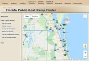
| Link:Florida Boat Ramp Finder | Florida Boat Ramp Finder | The Florida Fish and Wildlife Conservation Commission's Boat Ramp Finder provides descriptive information, maps and photographs for hundreds of public boat ramps throughout Florida. The Find-A-Boat-Ramp menu provides several options to search for the particular type of boat ramp you want to visit. As the condition and operation of boat ramps can change rather quickly, boaters are advised to check ahead before making a trip to an unfamiliar boat ramp. | Florida | Application | Boating | Fishing | Admin | 20191115202727 | |||||
| Link:Florida Department of Environmental Protection Information Portal | Florida Department of Environmental Protection Information Portal | The Florida Department of Environmental Protection (FDEP) Information Portal allows users to search for FDEP facilities and documents. | Florida | Database | Government Organizations | Research Resources | Admin | 20231115132150 | |||||
| Link:Florida Electronic Library | Florida Electronic Library | Since 2003, the Florida Electronic Library has provided over 190 million articles, e-books, videos and other electronic resources to the citizens of Florida. Florida residents and visitors with a public library card or who are enrolled in a Florida public school or university are invited to enjoy our collection. | Florida | Archive | Educational Material | Research Resources | Florida residents and visitors with a public library card or who are enrolled in a Florida public school or university. | Admin | 20210105195906 | ||||
| Link:Florida Gopher Tortoise Conservation Program | Florida Gopher Tortoise Conservation Program | Gopher tortoises are long-lived reptiles that occupy upland habitat throughout Florida including forests, pastures, and yards. In Florida, the gopher tortoise is listed as Threatened. Both the tortoise and its burrow are protected under Florida state law. Gopher tortoises must be relocated before any land clearing or development takes place, and property owners must obtain permits from the FWC before capturing and relocating tortoises. | Florida | Web Site | Conservation Resources | Conservation Resources • Wildlife | Admin | 20191117043207 | |||||
| Link:Florida Manatee - Stop the Starve Videos | Florida Manatee - Stop the Starve Videos | Stop the Starve Florida Manatee video playlist from Bear Warriors United. | Brevard County | YouTube Video | Wildlife | Admin | 20211222175200 | ||||||
| Link:Florida Memory Archive | Florida Memory Archive | Florida Memory archive is a digital outreach program providing free online access to select archival records from collections housed in the State Library and Archives of Florida. | Florida | Archive | History Links | Educational Material | The Florida Memory website digitizes Florida state archives and library collections. Digitized archives include: *Photographs *Historical Records *Maps *Audio *Video *Articles *Exhibits | Admin | 20210105175824 | ||||
| Link:Florida Memory Classroom | Florida Memory Classroom | The Florida Memory Classroom is designed to help teachers and students use photographs, documents, sound recordings and film footage from the State Library and Archives of Florida to explore history. | Florida | Archive | Educational Material | Classroom Learning Units include: *The Florida Seminoles *Florida in the Civil War *Railroads Change Florida *Florida During World War II *NASA and the Space Program Change Florida and many more. | Admin | 20210105182433 | |||||
| Link:Florida Today Newspaper | Florida Today Newspaper | Florida Today newspaper covers the Indian River Estuary in Brevard County. This link points to their "From the Water" series of articles. There were 2421 articles found for Indian River Lagoon on 17 Nov 2019. | Brevard County | Newspaper | Restoration Resources | Educational Material | Admin | 20191117225114 | |||||
| Link:Florida Water Resource Monitoring Catalog | Florida Water Resource Monitoring Catalog | The Florida WaterResource Monitoring Catalog is a searchable database of metadata, that allows anyone to find information about water resource monitoring activities in Florida. | Florida | Database | Water Quality Resources | The [https://water-cat.usf.edu/ Florida Water Resource Monitoring Catalog] is a searchable database that allows anyone with access to the internet to find information about [https://floridadep.gov/dear/watershed-monitoring-section water resource monitoring] activities in Florida. Each metadata element describes a sample site where information of some sort (chemical, physical, biological) is being collected about an individual water resource (lake, stream, estuary, ocean, watershed, aquifer, etc.). Metadata are contributed by individual organizations (local, state and federal environmental agencies, educational and research institutions, environmental consultants, testing laboratories, volunteer monitoring groups) that are performing the monitoring. Metadata are acquired directly from the organization performing the monitoring, or indirectly via regulatory agencies that receive routine submissions of water resource data. The goal of the Catalog is to help water resource managers better protect, preserve, manage and restore water resources in the state of Florida, by making it easier for them to coordinate water resource monitoring efforts and share information. The Catalog can also help researchers by letting them know what data have been collected, where they were collected, and how to acquire the data for their own analysis. Members of the public can use the Catalog to find out about monitoring activities being performed in their communities. The Catalog project is sponsored by the [https://floridadep.gov/ Florida Department of Environmental Protection] (DEP), with funding from the [https://www.epa.gov/ U.S. Environmental Protection Agency] . The [https://floridadep.gov/dear/watershed-monitoring-section/content/fwrmc Florida Water Resource Monitoring Council], created and coordinated by the DEP, is composed of stakeholders from many organizations and disciplines that participate in water resource monitoring and management statewide. Members of the Council provided guidance during the design and development of the Catalog. Design and implementation of the database and online tools to access it are being performed by the [https://waterinstitute.usf.edu/ USF Water Institute] at the [https://www.usf.edu/ University of South Florida] in Tampa. The Catalog project was initially proposed in 2008 as part of the Council's [http://publicfiles.dep.state.fl.us/DEAR/DEARweb/FWRMC/Action_Plan.pdf Monitoring-Coordination Action Plan]. Development was initiated in May 2013 and is substantially complete. It is anticipated that the Catalog will be retained indefinitely, with ongoing support for new metadata submissions, routine maintenance and scheduled updates. Sample sites represented in the catalog are located throughout the state of Florida. They monitor inland and coastal resources, water bodies (lakes, streams, bays, estuaries, oceans) and groundwater resources. Geographic Information Systems (GIS) technology is used by the Catalog to map sample sites to specific locations and to allow spatial searches. | Admin | 20230324181612 | |||||
| Link:Floridas Right to Clean Water Webinar | Floridas Right to Clean Water Webinar | Florida's Right to Clean Water Virtual Press Event. | Florida | YouTube Video | Water Quality Resources | https://www.floridarighttocleanwater.org/ https://www.facebook.com/floridarighttocleanwater.org | Admin | 20230305191632 | |||||
| Link:Freshwater and Marine Image Bank | Freshwater and Marine Image Bank | A public domain image archive from Washington University Libraries. | Archive | Educational Material | Wildlife | Admin | 20230408085312 | ||||||
| Link:From the Water: Healing the Indian River Lagoon | From the Water: Healing the Indian River Lagoon | A look at the problems plaguing the Indian River Lagoon, spanning 156 miles and six counties. Authored by Tim Walters and Jim Waymer for Florida Today newspaper. | Florida East Coast | YouTube Video | Restoration Resources | Educational Material | MERRITT ISLAND — The “perfect storm” began here, in the shallow waters that surround NASA’s premier launch pads. Extreme cold, drought and decades of pollution enabled a tiny algae to explode with cataclysmic consequences in the Indian River Lagoon. Scientists first discovered the algae in the Banana River after heavy rains in March 2011. The plankton soon enveloped Merritt Island and spread beyond what biologists had ever seen, stretching 70 miles south to Melbourne. They dubbed it a “superbloom.” It was unprecedented. The bloom would nearly wipe out the lagoon’s seagrass, ultimately killing a combined 73 square miles of the vital bottom plant — the linchpin of the marine food web. Other casualties included hundreds of manatees, pelicans and dolphins. Now an army of scientists, conservationists and volunteers are racing to restore the lagoon, a $3.7 billion annual economic engine, and to figure out what went wrong. What began as a perfect storm defies perfect solutions, they say. The answers, like the problems, are complex. There’s no one smoking gun, but a cumulative shotgun-blast of impacts from 1.7 million people who live in the five main counties along the lagoon — one of the most biologically diverse estuaries in North America. Biologists say the lagoon can be rescued. They point to multiple efforts, including dredges, oysters, volunteers, tax dollars, but most of all — stewards. Here’s what those who study and make their livings from the lagoon say must happen to heal the waterway. | Admin | 20191115164731 | ||||
| Link:Gopher Tortoise Council | Gopher Tortoise Council | The Gopher Tortoise Council was formed in 1978 by a group of southeastern biologists and other citizens concerned with the decline of the gopher tortoise. | Florida | Web Site | Non-Governmental Organizations | Wildlife | The goals of the Council are: (1) to offer professional advice for management, conservation, and protection of gopher tortoises; (2) to encourage the study of the life history, ecology, behavior, physiology, and management of gopher tortoises and other upland species; (3) to conduct active public information and conservation education programs; (4) to seek effective protection of the gopher tortoise and other upland species throughout the southeastern United States. | Admin | 20191117110919 | ||||
| Link:Gopher Tortoise Protection Video | Gopher Tortoise Protection Video | The Florida Fish and Wildlife Conservation Commission needs your help in protecting the state-threatened gopher tortoise.The tortoise and its burrow are protected by state law. If one lives in your yard, keep dogs and children away from the burrow. While driving, keep an eye out for these slow-moving creatures on roads. Please give them time to cross. The FWC has a free Florida Gopher Tortoise smartphone app you can download to help us gather information on the tortoises. You can take a photo of a gopher tortoise or a burrow and it will be sent automatically to the FWC along with its GPS coordinates. Also, you can learn facts about gopher tortoises and take a quiz on what you've learned. For more information, visit MyFWC.com/GopherTortoise. | Florida | YouTube Video | Wildlife | Conservation Resources • Educational Material | Admin | 20191117044747 | |||||
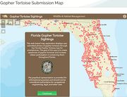
| Link:Gopher Tortoise Sighting Map | Gopher Tortoise Sighting Map | This web-based map application from Florida Fish and Wildlife Conservation Commission (FWC) displays user-submitted photos of gopher tortoises through the Florida Gopher Tortoise Sighting application. View Florida tortoise sightings searchable by location on this interactive map application. Report your own encounters to help the FWC track florida's remaining endangered tortoise population. | Florida | Map | Conservation Resources | Wildlife Encounter | Admin | 20191117040617 | |||||
| Link:Grand Canal Live Cam | Grand Canal Live Cam | Alternating north and south live cam views of the Grand Canal in Satellite Beach, FL allow you to see boaters, kayakers, dolphin, manatees, herons and other wildlife 24/7. Included with these live cam views are real-time weather conditions on the canal and NOAA satellite imagery of Florida. | Brevard County | YouTube Video | Places | The [https://www.youtube.com/watch?v=Xe_DUJJ68Es Grand Canal Live Cam] is provided by the [https://www.youtube.com/channel/UCYIDC8uaWwWoYTgrSWP-_GA Satellite Beach Live YouTube Channel]. | Admin | 20210217213132 | |||||
| Link:Harbor Branch Oceanographic Institute | Harbor Branch Oceanographic Institute | Florida Atlantic University’s Harbor Branch Oceanographic Institute is located in Fort Pierce on the Atlantic Coast. As one of the nation’s premier oceanographic centers, FAU Harbor Branch's research community of approximately 200 ocean scientists, staff and students drives innovation in: marine science and engineering; conservation of coral reefs, studies of marine mammals and fisheries; marine drug discovery; estuarine and coastal ecology and observation; ocean dynamics and modeling; aquaculture and marine science education. | Saint Lucie County | Web Site | Education College | Research Institute | Admin | 20191117174524 | |||||
| Link:Harbor Branch Virtual Learning Resources | Harbor Branch Virtual Learning Resources | Bring ''Ocean Science for A Better World®'' right into your home with virtual resources from [http://www.fau.edu/hboi/community/virtualresources.php FAU Harbor Branch]! Online offerings include lectures, interviews with marine scientists, activities for children and much more! | Saint Lucie County | Web Site | Virtual Learning | Education K-12 • Research Institute | Admin | 20200424121913 | |||||
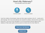
| Link:How is My Waterway? Application | How is My Waterway? Application | Provide your location and find out the condition of waterways near you. Learn the condition of local streams, lakes and other waters anywhere in the US... quickly and in plain language. See if your local waterway was checked for pollution, what was found, and what is being done. The source of this information is a US Environmental Protection Agency (EPA) database of State water quality monitoring reports provided under the Clean Water Act. Mobile or Browser App | United States | Application | Water Quality Resources | Admin | 20191116203920 | ||||||
| Link:Indian River Lagoon Educational Video Playlist | Indian River Lagoon Educational Video Playlist | Indian River Estuary educational video playlist. | Florida East Coast | YouTube Playlist | Educational Material | Education K-12 | Admin | 20191115190350 | |||||
| Link:Indian River Lagoon Health Update 2020 | Indian River Lagoon Health Update 2020 | Dr. Leesa Souto, Marine Resources Council executive director, presented the MRC's 2020 IRL Health Update Report Card #3 via webinar on December 8, 2020. | Florida East Coast | YouTube Video | Water Quality Resources | The [https://savetheirl.org/irl-health-update/ 2020 Indian River Lagoon Health Report Card] is a visual representation of the lagoon’s condition through the data collected as part of the state’s monitoring program to determine if state regulatory standards are being met. Bottom line is, we need to do more. The 2020 IRL Report Card includes: *137,202 agency data including 25 years of seagrass and 23 years of water quality data *10 lagoon regions and 12 tributaries covering from Ponce Inlet to Jupiter Inlet *Scored and color-coded tables and maps to easily see changes over time and space The report card represents the successful outcome of a public-private partnership between MRC and Applied Ecology Inc. (AEI) who have worked closely since 2015 to create an understandable translation of water quality and seagrass data. The report has successfully been used to guide scientific investigation, raise awareness, inspire advocacy, and inform policy-makers. | Admin | 20201213183113 | |||||
| Link:Indian River Lagoon Health Video Playlist | Indian River Lagoon Health Video Playlist | Water quality videos about the Indian River Estuary. | Florida East Coast | YouTube Playlist | Water Quality Resources | Educational Material | Admin | 20191115192535 | |||||
| Link:Indian River Lagoon History Video Playlist | Indian River Lagoon History Video Playlist | Indian River Lagoon History video playlist. | Florida East Coast | YouTube Playlist | History Links | Educational Material | Admin | 20191115193059 | |||||
| Link:Indian River Lagoon National Estuary Program Comprehensive Conservation and Management Plan | Indian River Lagoon Comprehensive Conservation and Management Plan | Each of the 28 National Estuary Programs was charged with developing and implementing a Comprehensive Conservation and Management Plan (CCMP) that establishes priorities for activities, research and funding for the estuary. The CCMP serves as a blueprint to guide future decisions and addresses a wide range of environmental protection issues. In the Spring and Summer of 2007, the Indian River Lagoon National Estuary Program (IRL NEP) embarked on a process to review and update the core of the 1996 Indian River Lagoon Comprehensive Conservation and Management Plan (CCMP), the set of 68 recommended action items in 4 topic areas that guide the IRL NEP‟s work. This initiative to update the CCMP was discussed by the IRL NEP Advisory Board during their April 2007 meeting, with direction to staff to generate a draft for review and comment. Eleven years of implementation activities under the original CCMP has resulted in a remarkable amount of progress toward restoration and protection of the lagoon. However, new issues and threats to the lagoon, such as climate change, toxic algae and exotic invasive fauna and flora have emerged since the original CCMP‟s development. In addition, new science, research, technologies, programs and organizations now exist. IRLNEP‟s activities and annual work plan projects have continually evolved within the existing CCMP framework over the previous eleven years trying to adapt to these new challenges and opportunities, however the action items in the CCMP have not been updated to reflect this evolution. Download: [https://www.epa.gov/sites/production/files/2015-09/documents/ccmp_update_2008_final.pdf Indian River Lagoon 2008 CCMP (PDF 120 pp, 4 MB)] | Florida East Coast | Document | Restoration Resources | Admin | 20191116131747 | ||||||
| Link:Indian River Lagoon National Estuary Program Comprehensive Conservation and Management Plan 2019 | Indian River Lagoon National Estuary Program Comprehensive Conservation and Management Plan 2019 | The IRL Council has the published the 2019 IRLNEP CCMP for review. This plan will be in effect until 2020. Download:[http://www.irlcouncil.com/uploads/7/9/2/7/79276172/irlnep_draft_final_ccmp_rev_2019-05-17_lowres.pdf 2019 IRNEP CCMP (PDF 218pp 16.4MB)] | Florida East Coast | Document | Restoration Resources | Admin | 20191129073607 | ||||||
| Link:Indian River Lagoon National Estuary Program Facebook | Indian River Lagoon National Estuary Program Facebook | Mission # To attain and maintain water and sediment of sufficient quality to support a healthy estuarine lagoon ecosystem; # To attain and maintain a functioning, healthy ecosystem which supports endangered and threatened species, fisheries, commerce and recreation; # To achieve heightened public awareness and coordinated interagency management of the Indian River Lagoon ecosystem; # To identify and develop long-term funding sources for prioritized projects and programs to preserve, protect, restore and enhance the Indian River Lagoon. | Florida East Coast | Restoration Resources | Admin | 20191117231251 | |||||||
| Link:Indian River Lagoon News | Indian River Lagoon News | IndianRiverLagoonNews.org is a non-partisan, non-commercial, non-affiliated website provided by a private entity as a service to Florida's East Coast Communities. The public is invited to join and share local IRL news, events, essays and photographs. | Florida East Coast | Web Site | Restoration Resources | Educational Material | Admin | 20200103192831 | |||||
| Link:Indian River Lagoon News Facebook | Indian River Lagoon News Facebook | Join us on the Indian River Lagoon Project Facebook Page for the latest IRL News, events, discussion and related posts from other IRL FB groups. | Florida East Coast | Restoration Resources | Admin | 20200103195636 | |||||||
| Link:Indian River Lagoon News YouTube Channel | Indian River Lagoon News YouTube Channel | Join us on our Indian River Lagoon You Tube Channel to view our IRLNews Video Uploads and other hand-picked You Tube videos sorted into Educational, Research, Restoration, History and Scenic Playlists. IRL Project Members are invited to share your YouTube Video links in our Web Link Directory. | Florida East Coast | YouTube Channel | Restoration Resources | Educational Material | Admin | 20200103201518 | |||||
| Link:Indian River Lagoon Observatory | Indian River Lagoon Observatory | The Indian River Lagoon Observatory (IRLO), based at FAU Harbor Branch in Fort Pierce, Florida, is investigating the IRL’s plants, animals, and environment, and how natural and human-induced stressors impact them. The goal of IRLO is to acquire and disseminate data and knowledge on the IRL critical to its ecological function and its sustainable management. | Saint Lucie County | Web Site | Education College | Research Institute | Admin | 20191117180423 | |||||
| Link:Indian River Lagoon Research Institute | Indian River Lagoon Research Institute (IRLRI) | A group of more than 20 faculty members with decades of scientific research experience related to the Indian River Lagoon have come together to form the Indian River Lagoon Research Institute (IRLRI). Collectively, Florida Tech scientists and engineers are developing solutions to the major issues plaguing the health of the lagoon, including muck and nutrients, lagoon flow, nutrient reduction, sediment loading, ecosystem recovery, policy and management, and engineering technologies. Part of the mission of the IRLRI also includes outreach and education to help the community and lagoon stakeholders understand the importance of IRL problems and their role in creating solutions. The IRLRI collaborates with numerous institutions and agencies along the lagoon with the common goal of improving the lagoon’s eco-system. | Brevard County | Web Site | Research Institute | Education College | Admin | 20191115162132 | |||||
| Link:Indian River Lagoon Research Video Playlist | Indian River Lagoon Research Video Playlist | Indian River Lagoon scientific research video playlist. | Florida East Coast | YouTube Playlist | Research Resources | Educational Material | Admin | 20191115192156 | |||||
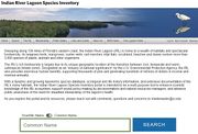
| Link:Indian River Lagoon Species Inventory | Indian River Lagoon Species Inventory | Following the first IRL Conference on Biodiversity held in 1994, the apparent lack of evidence to support claims of high biodiversity in the IRL prompted Dr. Hilary Swain and her colleagues Susan E. Hopkins and Clarissa L. Thornton to compile the Indian River Lagoon Species Inventory, a taxonomic listing of 2,493 species of protists, plants and animals occurring in the IRL. The inventory provided the first substantial evidence that attested to the high species richness of the IRL system. The Smithsonian Marine Station (SMS) at Fort Pierce became the depository for the Indian River Lagoon Species Inventory in 1997 and the database first went online in 1999. The new (2020) website design allows researchers and students to search the IRL Species Database by popular or scientific name. | Florida East Coast | Database | Wildlife | Educational Material • Virtual Learning • Research Resources | Admin | 20201103135525 | |||||
| Link:Indian River Lagoon Straight Talk with Dr. Duane De Freese 2020-01-22 | Indian River Lagoon Straight Talk with Dr. Duane De Freese | In this video, Dr. Duane De Freese, Executive Director of the Indian River Lagoon Council and the Indian River National Estuary Council talks about the work that's being done to help the Indian River Lagoon and what it will take to make sure this multigenerational, ambitious project continues to succeed. Dr. De Freese's talk is from a Lagoon Straight Talk event held on Wednesday, Jan. 22nd, 2020 at the Satellite Beach High School. | Brevard County | YouTube Video | Water Quality Resources | Educational Material • Restoration Resources | Admin | 20200128200842 | |||||
| Link:Indian River Lagoon Straight Talk with Virginia Barker, Satellite High School, January 2020 | Indian River Lagoon Straight Talk with Virginia Barker, Satellite High School, January 2020 | In this video, Virginia Barker, Director of Brevard County's Natural Resources Management Department, talks about the many projects that the county is pursuing to improve the Indian River Lagoon, what's been completed, what's in process and what is being planned for the future. She also shows how these projects are beginning to show a positive effect in the improvement in the Lagoon's water quality. Ms. Barker's talk is from a Lagoon Straight Talk event held on Wednesday, Jan. 22nd, 2020 at Satellite Beach High School. | Brevard County | YouTube Video | Water Quality Resources | Admin | 20200129150357 | ||||||
| Link:Indian River Lagoon Wildlife Video Playlist | Indian River Lagoon Wildlife Video Playlist | Indian River Lagoon National Estuary Wildlife video playlist. | Florida East Coast | YouTube Playlist | Wildlife | Educational Material | Admin | 20191115191517 | |||||
| Link:Indian Riverkeeper | Indian Riverkeeper | The mission of the Indian Riverkeeper is to protect and restore the waters of North America’s most diverse estuary, the Indian River Lagoon, its tributaries, fisheries and habitats through advocacy, enforcement and citizen action. | Florida East Coast | Web Site | Non-Governmental Organizations | Restoration Resources | Admin | 20201019035632 | |||||
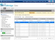
| Link:InfoBridge | InfoBridge | Federal Highway Administration's InfoBridge website uses the U.S. National Bridge Element (NBE) and Inspection (NBI) databases to present information about 617,084 bridges in America. Select Florida and "Show Bridges" to see the data on 5,622 bridges in Florida. | United States | Database | Research Resources | <h3>LTBP InfoBridge</h3> '''An intuitive and user-friendly interface to access, visualize, and analyze bridge performance data.''' [[File:InfoBridge_Brochure.jpg|300px|frameless|right|InfoBridge Website|link=https://infobridge.fhwa.dot.gov/]] The Long-Term Bridge Performance (LTBP) Program is a Federal Highway Administration (FHWA) long-term research effort to help the bridge community better understand bridge performance. The overall objectives of the LTBP Program are to monitor representative samples of bridges nationwide to collect, document, maintain, manage, and disseminate high-quality quantitative performance data over an extended time horizon. This will be accomplished by taking advantage of advanced nondestructive evaluation (NDE) and structural health monitoring (SHM) technologies in addition to traditional visual bridge inspection approaches. Achieving these objectives requires close collaboration with State transportation departments, academia, and industry. The LTBP Program is designed to collect critical performance data that are not available elsewhere and merge them with data gathered from available sources. The LTBP InfoBridge web portal is a centralized gateway providing efficient and quick access to bridge performance-related data and information. The portal includes multiple tools that facilitate bridge data analytics. It provides for storage, retrieval, dissemination, analysis, and visualization of data collected through State, National, and LTBP Program efforts to provide users with the ability to holistically assess bridge performance on a network or individual bridge basis. LTBP InfoBridge provides a user-friendly web front-end that includes intuitive tools for finding, viewing, and analyzing bridge performance information. It gives users the ability to efficiently share data selections and summary reports. Our goal at FHWA is to make LTBP InfoBridge a comprehensive bridge performance portal enabling researchers to develop tools and products that will enhance understanding of the performance of Gateway to Bridge Performance Information highway bridge assets leading to more efficient design, construction, rehabilitation, maintenance, preservation, and management of those assets. Source: [https://infobridge.fhwa.dot.gov/LTBP%20InfoBridge%20Brochure%20HRT-19-009.pdf LTBP InfoBridge Brochure (PDF 2pp)] Website: [https://infobridge.fhwa.dot.gov/Data InfoBridge] | Admin | 20201109174953 | |||||
| Link:IRL Council | IRL Council | The Indian River Lagoon National Estuary Program is sponsored by the IRL Council, which was established in February 2015 as a special district of Florida. The IRL Council includes representatives of five counties bordering the lagoon (Volusia, Brevard, the Indian River County Lagoon Coalition, St. Lucie and Martin counties), the St. Johns River and South Florida Water Management Districts, and the Florida Department of Environmental Protection (DEP). The U.S. EPA provides guidance to the Council. | Florida East Coast | Web Site | Restoration Resources | Conservation Resources | Admin | 20191116133546 | |||||
| Link:IRL Council Board of Directors Meeting 2021-05-14 | IRL Council Board of Directors Meeting 2021-05-14 | Video of the May 14, 2021 IRL Council Board of Directors Meeting at Sebastian City Hall. | Florida East Coast | YouTube Video | Government Organizations | Restoration Resources | Download: [https://onelagoon.org/wp-content/uploads/14-May-2021-BOD-Meeting-Package_Final.pdf IRL Council BOD Meeting Packet 2021-05-14] Highlights: 8.Water Quality Reports ( 36:24 ) a. Northern and Central Lagoon (Dr. Chuck Jacoby, SJRWMD) 36:24 b. St. Lucie County (Brandon Friedman, St. Lucie County) 47:50 c. Southern Lagoon (Dianne Hughes, Martin County) 49:33 10.Presentations (Duane De Freese to introduce speakers) 1:08:18 a. Brevard County Save Our Indian River Lagoon (SOIRL) Program (Virginia Barker, Director of Brevard County Natural Resources Management Department) 1:09:54 b. Update from GeoCollaborate on Harmful Algal Bloom Innovation project funded by FDEP. (Duane De Freese introduction, presentation by Dave Jones, CEO StormCenter Communications, Inc.) 1:57:13 13. IRLNEP Staff reports 2:47:14 a. Communication Report (Kathy Hill) b. Project Update (Daniel Kolodny) c. Executive Director Report (Duane De Freese) | Admin | 20210518133902 | ||||
| Link:IRL Discussion Facebook Group | IRL Discussion Facebook Group | This group is provided to discuss information and issues related to better understanding the problems and solutions toward effective and efficient restoration of the Indian River Lagoon. | Florida East Coast | Restoration Resources | Admin | 20191117204252 | |||||||
| Link:IRLNEP 2022 Annual Report | IRLNEP 2022 Annual Report | The Indian River Lagoon National Estuary Program (IRLNEP) has published it's 2022 Annual Report (pdf,25pp,89.5M). | Document | Restoration Resources | Educational Material | Admin | 20230408080623 | ||||||
| Link:Jacqui Thurlow-Lippisch Blog | Jacqui Thurlow-Lippisch Blog | Jacqui Thurlow-Lippisch’s blog tracks algae growth, toxic plumes, and shares information and political commentary. Her aerial photographs provide evidence of environmental damage to the St Lucie River and Indian River Lagoon. | Florida | Blog | Restoration Resources | Admin | 20201105104701 | ||||||
| Link:James' Blog | Dr. James G. Douglass, Marine Ecologist Personal Blog | Personal Blog by Dr, James G. Douglas, an ecologist interested in describing, protecting, and teaching about the biological diversity and beneficial ecosystem functions of coastal marine habitats. Coastal oceans are simultaneously threatened by decreasing water quality, changing physical conditions, and overharvest of ecologically important species. I address the interactive effects of these threats through conservation-directed research and teaching at Florida Gulf Coast University. | Blog | Research Resources | Admin | 20191117210417 | |||||||
| Link:Jill Bazeley Photography | Jill Bazeley Photography | Beautiful photographs of Indian River Estuary places, things and events on Jill Bazeley's Flickr Photostream. | Brevard County | Flickr | Sightseeing | Admin | 20191115143917 | ||||||
| Link:Manatee Field Guide Story Map | Manatee Field Guide Story Map | The Manatee Field Guide is an interactive story map about Florida manatees, where to view manatees on Florida's Space Coast, and how to protect manatees and their habitat in the Indian River Lagoon. | Brevard County | Story Map | Virtual Learning | Manatee Watching | "Many Florida manatees live year-round in the shallow, brackish water of the Indian River Lagoon, where they spend most of their days eating, resting, investigating objects, and socializing with other manatees." The Manatee Field Guide Map displays 29 Florida manatee watching locations in Brevard County. '''See Also:''' [https://helpthelagoon.org/wp-content/uploads/2021/05/Space-Coast-manatee-field-guide.pdf Space Coast Manatee Field Guide Brochure (PDF 3pp 3.7MB)] | Admin | 20211211092339 | ||||
| Link:Marine Ecology Lectures by James Douglass | Marine Ecology Lectures by James Douglass | Dr. James Douglass, Marine Biology Professor at Florida Gulf Coast University, has recorded all of his lectures for Marine Ecology "OCB4633C" and offers them free to the public on his YouTube channel. | YouTube Channel | Research Resources | Educational Material • Virtual Learning | Dr. Douglass: "One bonus of producing recorded teaching materials is that I can make them available for free to interested members of the public. I have done this with the lectures for my Marine Ecology course "OCB4633C." This is a required course in the BS Marine Science program at colleges in the Florida State University system. I recorded the lectures by doing "voice overs" of my existing PowerPoint slideshow presentations, then converting the presentations to video and uploading them to YouTube. " Dr. Douglass' Lecture Topics include: *Estuarys *Seagrass, Saltmarsh, and Mangroves *Coral Reefs *Intertidal Ecology *Deep Sea *Fisheries *Pollution and Climate Change Link: [https://jimbodouglass.blogspot.com/2020/04/learn-marine-ecology-my-narrated.html Professor James Douglass Blogspot] | Admin | 20210112093508 | |||||
| Link:Marine Resource Council Virtual Learning | Marine Resource Council Virtual Learning | The [https://savetheirl.org/education/virtual-learning Marine Resources Council] is offering virtual learning programs for grades 3-6. Each program is aligned with the Next Generation Sunshine State Standards and consists of a video presentation and a worksheet. | Florida East Coast | Web Site | Virtual Learning | Education K-12 | *IRL and Stormwater Introduction (video 15 mins): Students will be introduced to the unique and amazing ecosystem of the Indian River Lagoon (IRL)! Students will also learn about stormwater runoff and the effects of pollution on the IRL. *Florida Feasts (video 13 mins): Students will learn about energy flow in food chains/webs using animals from the Indian River Lagoon and will learn how pollution disrupts these relationships. *Mangroves Matter (video 18 mins): Students will learn about the different species of mangroves in Florida and their life cycles. Students will also learn how mangroves are able to thrive in their unique environment and their importance for lagoon restoration. *Help Save the Lagoon (video 8 mins): Students will learn about the simple actions they can do at home that can make a big impact on saving the lagoon! | Admin | 20200424112612 | ||||
| Link:Marine Resources Council 2020 IRL Health Report | Marine Resources Council 2020 IRL Health Report | The Marine Resources Council Indian River Lagoon Health Update visually represents 25 years of water quality data using easy to understand charts, tables, and maps. Visit the MRC website to see how your water rates. | Brevard County | Web Site | Water Quality Resources | Admin | 20201213071500 | ||||||
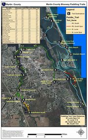
| Link:Martin County Blueway Paddling Trails | Martin County Blueway Paddling Trails | Indian River Lagoon and St. Lucie River Paddling Trails (PDF 5pp 1.15MB). The Martin County paddling trails span 37.7 miles of two river systems - the Indian River Lagoon and St. Lucie River. | Martin County | Map | Paddling | The Indian River Lagoon portion of the trail is 16.2 miles long and spans between Jensen Beach and Hobe Sound. This portion of the trail is a part of the Indian River Lagoon Aquatic Preserve. There are 8 different public launch or stopover sites along the trail. There is also a 2.6 mile trail spur that goes through St. Lucie Inlet State Park. The St. Lucie River (South Fork) portion of the trail is 21.5 miles and extends from the Atlantic Ridge State Park/ Halpatiokee area to sites near the Indian River Lagoon and the St. Lucie Inlet. There are 13 different public launch or stopover sites along the trail. There is also a 3.6 mile trail spur that runs between Atlantic Ridge and the Halpatiokee County Preserve. | Admin | 20191117115948 | |||||
| Link:Mathers Bridge Part 1: The Mathers Experience | Mathers Bridge Part 1: The Mathers Experience | Mathers Bridge is an iconic landmark on the Florida Space Coast. In Part I of this two part documentary series, we explore what it's like to experience the bridge first hand and start the interesting conversation about its long history. | Brevard County | YouTube Video | Places | History Links | Admin | 20210212214810 | |||||
| Link:Mathers Bridge Part 2 - The History | Mathers Bridge Part 2 - The History | Mathers Bridge has quite a long history that extends back over 100 years when pioneer John Mathers first started farming pineapples on Merritt Island. In this video, Lola Mathers Haskins, granddaughter of John Mathers, takes us on a personal journey of the early years of the bridge and her experiences in the area as a youth. | Brevard County | YouTube Video | Places | History Links | Admin | 20210212215510 | |||||
| Link:Merritt Island Adventure | Merritt Island Adventure | This video is a documentary of the lives of the homesteaders living on Merritt Island in Florida in the area that is now owned by NASA operating the Kennedy Space Center and also managed as Merritt Island National Wildlife Refuge. NASA used eminent domain to acquire the property in the late 1950's - 60's. Here are the stories of how people lived very primitively on the land and what happened when they were forced to move. | Brevard County | YouTube Video | History Links | Educational Material • National Wildlife Refuges | For this film, they were brought back to the homestead, back to the very foundations where they still existed. Some early settlers are able to visit their home sites where the land is open to the public; however, some have never had access to their home site because it lies within the security area of Kennedy Space Center. Although residents were forced to move, they are glad the land is protected as a National Wildlife Refuge and not developed like so much of the Florida coastline. The refuge remains pristine and very similar to how they remembered growing up there. | Admin | 20191117135908 | ||||
| Link:Merritt Island National Wildlife Refuge | Merritt Island National Wildlife Refuge | In 1962, NASA acquired 140,000 acres of land, water, and marshes adjacent to Cape Canaveral to establish the John F. Kennedy Space Center. NASA built a launch complex and other space-related facilities, but development of most of the area was not necessary. In 1963 the U.S. Fish and Wildlife Service signed an agreement to establish the refuge and in 1975 a second agreement established Canaveral National Seashore. Today, the Department of Interior manages most of the unused portions of the Kennedy Space Center as the Merritt Island National Wildlife Refuge and Playalinda National Seashore. | Brevard County | Web Site | National Wildlife Refuges | Paddling • Primitive Camping • Fishing • Scenic Drive • Wildlife Encounter • Bird Watching • Manatee Watching | Admin | 20191114134457 | |||||
| Link:Merritt Island National Wildlife Refuge Facebook | Merritt Island National Wildlife Refuge Facebook | Great wildlife photos and current refuge news available from the MINWR Facebook page. Many recreational opportunities are offered at the Refuge. Bird and wildlife observation, a wildlife drive, manatee observation deck, fishing and hunting opportunities, and boating and paddling are examples of available activities. The Visitor Information Center located 4 miles east of Titusville, Florida, is a great place to start your visit. | Brevard County | National Wildlife Refuges | Primitive Camping • Fishing • Scenic Drive • Wildlife Encounter | Admin | 20191117122606 | ||||||
| Link:Merritt Island Wildlife Association | Merritt Island Wildlife Association | The Merritt Island Wildlife Association (MIWA) is a Florida 501 (c) (3) nonprofit corporation that has been helping to support the Merritt Island National Wildlife Refuge since 1994. Our mission is to promote conservation, awareness, appreciation, and use of the Merritt Island National Wildlife Refuge (MINWR) and to support Refuge programs. | Brevard County | Web Site | National Wildlife Refuges | Wildlife | Through the ongoing efforts of MIWA, our volunteers and members, we have been able to provide much needed annual funding for programs that include environmental education, community outreach, internships and volunteers. We help fund refuge projects and events, such as construction of the Sendler Education Outpost Pavilion, Black Point Wildlife Drive observation deck and restroom facilities. We are currently fundraising for the new exhibits that will be the centerpiece of the new MINWR Community Conservation and Education Center. | Admin | 20191118213725 | ||||
| Link:Merritt Island Wildlife Association Facebook Page | Merritt Island Wildlife Association Facebook Page | The purpose of the Merritt Island Wildlife Association (MIWA) is to promote conservation, awareness and appreciation of the Merritt Island National Wildlife Refuge and to provide assistance to Refuge programs. MIWA is a 501(c)3 that helps support Merritt Island National Wildlife Refuge through memberships, charitable donations and proceeds from our nature store. | Brevard County | National Wildlife Refuges | Wildlife | Admin | 20191118215323 | ||||||
| Link:Merritt Island Wildlife Association Flickr Photostream | Merritt Island Wildlife Association Flickr Photostream | Great flora and fauna photos in the MIWA's Flickr photostream. | Brevard County | Flickr | National Wildlife Refuges | Sightseeing • Wildlife Encounter | The Merritt Island Wildlife Association (MIWA) is a 501(c) (3) non-profit organization partnered with the Merritt Island National Wildlife Refuge (MINWR). The Refuge protects over 140,000 acres of threatened endangered species and wildlife diversity. MIWA currently has over 1,400 members who furnish volunteers and finance educational programs, materials, and equipment for the Refuge. Our purpose is to promote conservation, awareness, and appreciation of the Refuge and to provide assistance to Refuge programs. Due to federal budget cutbacks many programs would not take place without the support of MIWA and its dedicated volunteers. MIWA relies on donations, grant awards and generous private businesses and companies that donate funds, materials, and resources to assist in our efforts. We also operate the Bookery, a nature based bookstore and gift shop located in the Refuge Visitor’s Center, with all proceeds going directly into Refuge projects. | Admin | 20191118215714 | ||||
| Link:NASA Causeway Bridge Replacement and Final Plan Presentation | NASA Causeway Bridge Replacement and Final Plan Presentation | NASA Causeway (SR405) Bridge Replacement and final Design presentation slides from Volkert, Inc. and FDOT. | Brevard County | Document | NASA - KSC | Admin | 20210228195837 | ||||||
| Link:NASA KSC presents the Indian River Lagoon Health Initiative Plan to the IRL National Estuary Program | NASA KSC presents the Indian River Lagoon Health Initiative Plan to the IRL National Estuary Program | NASA's Kennedy Space Center (KSC) environmental biologist Jeff Collins presented the KSC Indian River Lagoon Health Initiative Plan to the Indian River Lagoon National Estuary Program Management Board meeting on Nov 16, 2021. | Brevard County | YouTube Video | NASA - KSC | Restoration Resources | NASA's Kennedy Space Center (KSC) recently developed the [[IRLNews:Kennedy Space Center Develops Indian River Lagoon Health Initiative Plan|Indian River Lagoon Health Initiative Plan]] to provide a framework for KSC and its partners to navigate the unique relationship between the space center and the [[Indian River Lagoon Estuary|Indian River Lagoon (IRL) National Estuary]]. The national estuary is on and adjacent to the spaceport, and the plan proposes restoration projects and actions directly addressing current environmental challenges. Improving the understanding of water quality, gaining information for sound land management, and creating actionable projects and restoration actions based on that information are the key aims of the plan. Many of the proposed restoration projects are in direct response to what has been observed by decades of monitoring the health of the soil, vegetation, and wildlife in the Indian River lagoons around Kennedy Space Center. These projects include muck removal, reducing reliance on septic tanks and removing those already decommissioned, restoring shellfish to improve water clarity, and expanding living shorelines. See Also: [[IRLNews:Kennedy Space Center Develops Indian River Lagoon Health Initiative Plan|KSC Develops Indian River Lagoon Health Initiative Plan]] | Admin | 20211119050236 | ||||
| Link:NASA Technical Reports Server | NASA Technical Reports Server | NASA Technical Reports Server (NTRS) provides access to NASA metadata records, full-text online documents, images, and videos. Search for publicly available conference papers, journal articles, meeting papers, patents, research reports, images, movies, and technical videos. | United States | Archive | Research Resources | Educational Material | The NASA STI Repository (also known as the NASA Technical Reports Server (NTRS)) provides access to NASA metadata records, full-text online documents, images, and videos. The types of information included are conference papers, journal articles, meeting papers, patents, research reports, images, movies, and technical videos – scientific and technical information (STI) created or funded by NASA. By maintaining the Repository, the STI Program supports NASA’s strategic goals to *Expand the frontiers of knowledge, capability, and opportunity in space. *Advance understanding of Earth and develop technologies to improve the quality of life on our home planet. *Serve the American public and accomplish our Mission by effectively managing our people, technical capabilities, and infrastructure. | Admin | 20211011101915 | ||||
| Link:National Estuary Program | National Estuary Program | The Environmental Protection Agency's National Estuary Program (NEP) is a collaborative, efficient, and adaptable ecosystem-based network of organizations that protect and restore 28 estuaries of national significance. | United States | Web Site | Restoration Resources | Research Resources | Admin | 20191116080440 | |||||
| Link:National Estuary Program Booklet | National Estuary Program Booklet | The National Estuary Program Booklet provides an overview of the program and describes how NEPs are effective, efficient, collaborative and adaptive community-based programs. Order printed publications from the [https://www.epa.gov/nscep National Service Center for Environmental Publications] | United States | Document | Conservation Resources | Educational Material • Restoration Resources | Admin | 20191116112425 | |||||
| Link:National Estuary Program Habitat Protection and Restoration Book | National Estuary Program Habitat Protection and Restoration Book | The Habitat Protection and Restoration Book provides photographs and detailed information from each National Estuary Program. Download:<br/>[https://www.epa.gov/sites/production/files/2015-09/documents/nep_booklet_online.pdf Online NEP Book (PDF 100 pp, 59 MB)]<br/>[https://www.epa.gov/sites/production/files/2015-09/documents/nep_booklet_print.pdf Printable NEP Book (PDF 51 pp, 11 MB)] | United States | Document | Conservation Resources | Educational Material | Admin | 20191116121605 | |||||
| Link:National Estuary Program Map | National Estuary Program Map | This interactive map from the EPA displays the National Estuaries and the ongoing and completed restoration projects. Zoom into Indian River Estuary to see the projects in our area. | United States | Story Map | Conservation Resources | Restoration Resources | Admin | 20191116110314 | |||||
| Link:National Estuary Program Story Map | National Estuary Program Story Map | Since 1987, the EPA National Estuary Program (NEP) has made a unique and lasting contribution to protecting and restoring our nation's estuaries, delivering environmental and public health benefits to the American people. This interactive story map describes the 28 National Estuary Programs, the issues they face, and how place-based partnerships coordinate local actions. [https://www.epa.gov/sites/production/files/2018-03/documents/text_only_version_of_nep_story_map.pdf View Story Map Text Only] | United States | Story Map | Conservation Resources | Educational Material • Restoration Resources | Admin | 20191116092600 | |||||
| Link:National Estuary Program Story Map Text | National Estuary Program Story Map Text | Story Map Text about the 28 National Estuary Programs located along the Atlantic, Gulf, and Pacific coasts and in Puerto Rico. | United States | Document | Conservation Resources | Educational Material | The NEPs employ a watershed approach, extensive public participation, and collaborative science-based problem solving to address watershed challenges. To address these challenges, the NEPs develop and implement long-term plans (called Comprehensive Conservation and Management Plans) to coordinate local actions. The NEPs and their partners have protected and restored approximately 2 million acres of habitat. On average, NEPs leverage $19 for every $1 provided by the EPA, demonstrating the value of federal government support for locally-driven efforts. | Admin | 20191116095844 | ||||
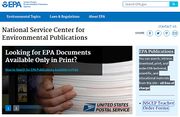
| Link:National Service Center for Environmental Publications | National Service Center for Environmental Publications | Environmental Protection Agency publications, you can search, view, retrieve, download, print, and order EPA technical, scientific, and educational materials from this site – all free of charge! | United States | Archive | Educational Material | Admin | 20191116123744 | ||||||
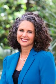
| Link:Ocean Allison Podcast - Jacqui Thurlow-Lippisch | Ocean Allison Podcast - Jacqui Thurlow-Lippisch | Jacqui Thurlow-Lippisch is a Martin County, Florida conservationist dedicated to improving the health of South Florida's troubled waterways. Long involved in Florida's conservation and political arena, Thurlow-Lippisch is leading the movement to stop toxic algae filled water from plaguing her community. Jacqui provides St. Lucie and Indian River environmental information and uses aerial photography to monitor Lake Okeechobee algae blooms on her personal blog at [https://jacquithurlowlippisch.com www.jacquithurlowlippisch.com]. Hear what it's like to be on the front lines of the 2016 Indian River Lagoon environmental catastrophe. | Martin County | Podcast | Restoration Resources | Jacqui_Thurlow-Lippisch.jpg | Admin | 20201030082253 | |||||
| Link:One Community, One Voice, One Lagoon | One Community, One Voice, One Lagoon | I am the Indian River Lagoon, a complex eco-system that has been a source of economic prosperity and enrichment for the entire state of Florida for decades, but now I’m suffering. Working together as one community, and speaking in one voice is the solution to my survival. | Florida East Coast | YouTube Video | Restoration Resources | Educational Material | Admin | 20191117233745 | |||||
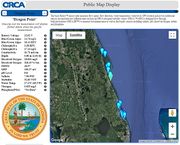
| Link:ORCA Kilroy IRL Water Quality Monitor System Map | ORCA Kilroy IRL Water Quality Monitor System Map | [https://www.teamorca.org/ Ocean Research & Conservation Association (ORCA)'s] Water Quality Monitoring System uses the Kilroy™ sensor suite to measure Indian River Lagoon flow speed, flow direction, water temperature, water level, GPS location and power. Additional sensors incorporated into different units include an ORCA-designed turbidity sensor (ORCA ™),ORCA-designed flow-through bathyphotometer (ORCA BP™) to measure bioluminescence as well as third-party sensors including salinity, pH, dissolved oxygen, nitrate and phosphate in REAL TIME. | Florida East Coast | Dashboard | Water Quality Resources | Research Institute | This introductory video guides users to navigate ORCA's interactive Public Kilroy Map Display and Database to access real-time Kilroy data from the Indian River Lagoon. <div class="irlvideo">'"`UNIQ--item-4--QINU`"'</div> | Admin | 20200128204457 | ||||
| Link:Our Indian River Lagoon | Our Indian River Lagoon | Indian Riverkeeper Marty Baum introduces us to our Indian River Lagoon, some of the challenges it's facing, how we are affecting it and how we can help it. | Florida East Coast | YouTube Video | Restoration Resources | Educational Material | Admin | 20191117222926 | |||||
| Link:Outdoor Florida | Outdoor Florida | Outdoor Florida is your source for finding available recreational opportunities across Florida’s diverse public lands system. From camping, to boating, to hiking and biking, opportunities are around every corner in Florida. This mobile application will help you find the perfect Florida outdoor adventure using searches based on location and activity. | Florida | Application | Florida State Parks | Boating • Camping • Fishing • Sightseeing • Wildlife Encounter | Admin | 20191117031509 | |||||
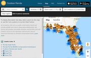
| Link:Outdoor Florida Map | Outdoor Florida Map | 3,000 Florida outdoor recreation areas searchable by activity and location are available on this interactive map. All recreation sites are on public conservation lands and include wildlife and nature observation.Additionally, this service will provide searchable activities and facilities that will enhance access to the abundant natural and cultural resources that exist on Florida’s conservation lands. | Florida | Dashboard | Florida State Parks | Boating • Camping • Fishing • Sightseeing • Wildlife Encounter | Admin | 20191117033454 | |||||
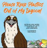
| Link:Please Keep Plastics Out of My Lagoon | Please Keep Plastics Out of My Lagoon | This UCF-CEELAB children's book introduces young people to the important topic of microplastics and the amazing biodiversity of organisms in warm-water estuaries. | Brevard County | Childrens Book | Educational Material | Everyone is talking about plastic pollution. In this book for young audiences, we provide information on plastic pollution, including microplastics. We describe some of the many animals found in our favorite estuary, the Indian River Lagoon, that are impacted by plastics. This book asks young readers to pick the items they want to see in their lagoon, "This animal friend or that harmful piece of plastic?" '''Author:''' [https://stars.library.ucf.edu/do/search/?q=author_lname%3A%22Walters%22%20author_fname%3A%22Linda%22&start=0&context=7014507 Linda Walters, ''University of Central Florida''] '''Publisher:''' University of Central Florida (UCF) [https://sciences.ucf.edu/biology/ceelab/ Coastal and Estuarine Ecology Lab (CEELAB)] '''Download:''' https://stars.library.ucf.edu/cgi/viewcontent.cgi?article=1009&context=ceelabbooks | Admin | 20220613065326 | |||||
| Link:Recreation Gov | Recreation Gov | Discover new experiences, historic landmarks, and outdoor escapes right down the road or across the country. From camping, hiking, and horseback riding to wildlife viewing, monument tours, and ranger-led activities – [https://www.recreation.gov/ Recreation.gov] will help you dream up your next trip, figure out the details, and reserve experiences at over 3,500 facilities and 100,000 individual sites across the country. | United States | Application | Recreation | National Parks | Admin | 20191117034627 |

