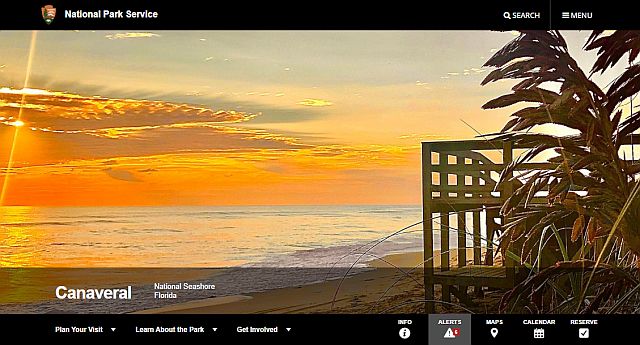
Canaveral National Seashore
Twenty four mile long Canaveral National Seashore is the longest stretch of undeveloped beach remaining on Florida's east coast.
About

Canaveral National Seashore is an outdoor lover's paradise. Recreational activities include scenic drives, hiking, fishing, paddling, wildlife watching, and primitive camping.
The national seashore's northern entrance is at Apollo Beach in Volusia County's New Symyrna. The southern entrance is at Playalinda Beach, due east of Titusville in Brevard County. Both visitor centers are usually open 9am-5pm. The park is usually open from 6am until dusk. Admission is $15 for automobiles and $10 for motorcycles. Visit the Canaveral National Seashore website for current news and information.
The Canaveral National Seashore was created through congressional legislation on January 3, 1975 (by Public Law 93-626) to preserve and protect the natural, scenic, scientific, ecological, archeological, and historical values and resources within the national seashore, and to provide for public outdoor recreational use and enjoyment of those resources.
Geography
7611 S Atlantic Ave, New Smyrna Beach, FL 32169
( 28°55'37.8"N 80°49'26.8"W )
The Canaveral National Seashore's 24 miles of pristine, undeveloped beach represent an excellent example of a stable barrier beach island backed by a productive lagoon system.
The national seashore is a barrier island ecosytem that contains nearly 58,000 acres of bar-built barrier island, open lagoon, coastal hammock, pine flatwoods, and offshore waters. The Canaveral seashore is prime habitat for many threatened and endangered species and provides nesting beaches for several thousand protected marine turtles.
Canaveral's barrier island is the eastern boundary of Mosquito Lagoon. The brackish water lagoon encompasses more than two-thirds of the national seashore, and is a part of the Indian River Lagoon National Estuary. It is one of the most diverse and productive estuaries in North America.[1]
Canaveral National Seashore is managed by the National Park Service in partnership with the National Aeronautics and Space Administration (NASA). NASA owns approximately two-thirds of the national seashore, along with the adjacent U.S. Fish and Wildlife Service's Merritt Island National Wildlife Refuge.
History

Turtle Mound
Turtle Mound is a 50' tall shell midden made by the Timucuan Indians starting around 1200 AD. The mound was built from oyster shells discarded by the Timucuans as they consumed the Mosquito Lagoon's bountiful oyster bars. While most shell middens on Florida's east coast were destroyed and used for land fill on road projects, Turtle Mound, along with Canaveral National Seashore, was purchased in 1924 by The Florida State Historical Society for $8,000.[2] Today, Turtle Mound is an active archeological dig.

Historic Eldora House
Eldora was a prominent community of orange groves in the latter part of the 19th century. After a freeze destroyed most of its crops, it was almost abandoned and has never regained its population.
After the death of its last resident, Doris "Doc" Leeper in 2000, a locally famous artist and conservationist in the 1980s, the management of Eldora was officially turned over to the federal government, and the town is now located more than two miles within the borders of the Canaveral National Seashore.
Eldora claims no permanent residents and only two of its original buildings remain. The largest, "The Eldora House", now holds a museum. The town is now the site of two marine research facilities jointly shared by Daytona State College and the University of Central Florida.


.jpg)
.jpg)