Canaveral National Seashore: Difference between revisions
mNo edit summary |
m (→Images) |
||
| Line 29: | Line 29: | ||
<div class="irlgallery"><!-- Image Gallery div --> | <div class="irlgallery"><!-- Image Gallery div --> | ||
==Images== | ==Images== | ||
<gallery mode=slideshow widths=420px | <gallery mode=slideshow widths=420px> | ||
File:Cana4997.jpg | File:Cana4997.jpg | ||
File:Canaveral-National-Seashore-Apollo-Beach.jpg | File:Canaveral-National-Seashore-Apollo-Beach.jpg | ||
| Line 46: | Line 46: | ||
</div><!-- End Content Mid 2 div --> | </div><!-- End Content Mid 2 div --> | ||
</div><!-- End Content Middle div --> | </div><!-- End Content Middle div --> | ||
<div class="irlcontentbottom"><!-- Content Bottom Div --> | <div class="irlcontentbottom"><!-- Content Bottom Div --> | ||
<div class="irlcontentweblinks"><!-- Web Links Div --> | <div class="irlcontentweblinks"><!-- Web Links Div --> | ||
==Web Links== | ==Web Links== | ||
* [https://www.nps.gov/cana/ Canaveral National Seashore] | * [https://www.nps.gov/cana/ Canaveral National Seashore] | ||
Revision as of 18:15, November 14, 2019
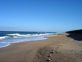
At 24 miles long, Canaveral National Seashore is the longest remaining stretch of undeveloped beach on Florida's east coast.
About
Canaveral National Seashore was created through congressional legislation on January 3, 1975 (by Public Law 93-626) to preserve and protect the natural, scenic, scientific, ecological, archeological, and historical values and resources within the national seashore, and to provide for public outdoor recreational use and enjoyment of those resources.
Canaveral National Seashore is managed by the National Park Service in partnership with the National Aeronautics and Space Administration (NASA). NASA owns approximately two-thirds of the national seashore, along with the adjacent U.S. Fish and Wildlife Service's Merritt Island National Wildlife Refuge. Vehicle traffic is often stopped during rocket launches, but the beach usually remains open, and provides an excellent, close-up launch viewing area.
Canaveral National Seashore's 24 miles of pristine, undeveloped beach represents an excellent example of a stable barrier beach island backed by a productive lagoon system. The seashore is comprised of a barrier island ecosytem and contains nearly 58,000 acres of bar-built barrier island, open lagoon, coastal hammock, pine flatwoods, and offshore waters. The seashore is prime habitat for many threatened and endangered species and provides nesting beaches for several thousand protected marine turtles. Canaveral's barrier island is the eastern boundary of Mosquito Lagoon. The lagoon encompasses more than two-thirds of the national seashore, and is designated an estuary of national significance. It is one of the most diverse and productive estuaries in North America.
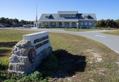
The Canaveral National Seashore northern entrance is at Apollo Beach in Volusia County's New Symyrna. The southern entrance is at Playalinda Beach, due east of Titusville in Brevard County. Both visitor centers are usually open 9am-5pm. The beach is open from 6am until dusk. Admission is $15 for automobiles and $10 for motorcycles. Visit the Canaveral National Seashore website for current news and information.

