Page values for "Link:ORCA Kilroy IRL Water Quality Monitor System Map"
From Indian River Lagoon Project
"weblink" values
1 row is stored for this page| Name | ORCA Kilroy IRL Water Quality Monitor System Map |
| Link_Url | http://api.kilroydata.org/public/ |
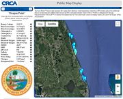
| Description | [https://www.teamorca.org/ Ocean Research & Conservation Association (ORCA)'s] Water Quality Monitoring System uses the Kilroy™ sensor suite to measure Indian River Lagoon flow speed, flow direction, water temperature, water level, GPS location and power. Additional sensors incorporated into different units include an ORCA-designed turbidity sensor (ORCA ™),ORCA-designed flow-through bathyphotometer (ORCA BP™) to measure bioluminescence as well as third-party sensors including salinity, pH, dissolved oxygen, nitrate and phosphate in REAL TIME. |
| Region | Florida East Coast |
| Type | Dashboard |
| Topic | Water Quality Resources |
| Subtopic | Research Institute |
| Screenshot | |
| Text_Body | This introductory video guides users to navigate ORCA's interactive Public Kilroy Map Display and Database to access real-time Kilroy data from the Indian River Lagoon. <div class="irlvideo">'"`UNIQ--item-4--QINU`"'</div> |
| Poster | Admin |
| Posted | 20200128204457 |
