View table: Waterbody
Table structure:
- Name - String
- WBID - String
- Type - String
- Water - String
- County - String
- Coordinates - Coordinates
- Description - Wikitext
- Image - File
- Article - Page
- Link1 - URL
- Link2 - URL
- Link3 - URL
- Poster - String
- Posted - String
This table has 27 rows altogether.
| Page | Name | WBID | Type | Water | County | Coordinates | Description | Image | Article | Link1 | Link2 | Link3 | Poster | Posted |
|---|---|---|---|---|---|---|---|---|---|---|---|---|---|---|
| Info:Addison Creek | Addison Creek | 2963EA | Creek | Indian River | Brevard | 28.54514,-80.78769 | Addison Creek runs through Brevard County's Enchanted Forest Nature Sanctuary before entering the Indian River lagoon at Addison Point, Florida, |
Admin | 20210520065623 | |||||
| Info:Banana Creek | Banana Creek | 3057C | Creek | Banana River | Brevard | 28.60073,-80.66184 | Banana Creek connects Banana River lagoon to the Indian River lagoon south of Max Brewer Bridge (SR404) in Titusville, Florida. |
Admin | 20210502064443 | |||||
| Info:Banana River | Banana River | 3057B | Lagoon | Banana River | Brevard | 28.44858,-80.62544 | Lying entirely within Brevard County, 31 mile long, 30,000 acre Banana River is the smallest lagoon basin in the Indian River Lagoon National Estuary. |
Banana River | Admin | 20210422055823 | ||||
| Info:Big Flounder Creek | Big Flounder Creek | 2963F3 | Creek | Indian River | Brevard | 28.75528,-80.84417 | Big Flounder Creek is located near Scottsmoor, Florida in the North Indian River lagoon. |
Admin | 20210520064352 | |||||
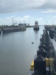
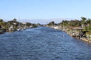
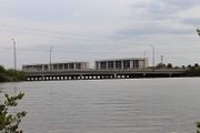
| Info:Canaveral Barge Canal East | Canaveral Barge Canal East | 3044B | Canal | Banana River | Brevard | 28.40942,-80.68977 | Canaveral Barge Canal cuts thru Merritt Island, Florida to connect the Banana River and Indian River lagoons. |
Merritt Island FL barge canal01.jpg | Canaveral Barge Canal | Admin | 20210502074551 | |||
| Info:Canaveral Barge Canal West | Canaveral Barge Canal West | 2963D1 | Canal | Indian River | Brevard | 28.40942,-80.68977 | A part of the Atlantic Intracoastal Waterway, Canaveral Barge Canal cuts thru Brevard County's Merritt Island to connect the Banana River and Indian River lagoons. |
Merritt Island FL barge canal01.jpg | Canaveral Barge Canal | Admin | 20210502074551 | |||
| Info:Canaveral Lock | Canaveral Lock | 3057B | Canal | Banana River | Brevard | 28.40926,-80.64058 | Located between Port Canaveral's West turning basin and the Banana River, Canaveral Lock was constructed by the US Army Corps of Engineers in 1965 to secure safe passage of vessels from the Banana River to Port Canaveral and the Atlantic Ocean. |
Canaveral Lock | Admin | 20210502074015 | ||||
| Info:Catfish Creek | Catfish Creek | 2963EA | Creek | Indian River | Brevard | 28.61681,-80.77637 | Catfish Fish Creek is located in Merritt Island National Wildlife Refuge in Titusville, Florida. |
Admin | 20210516203950 | |||||
| Info:Crane Creek | Crane Creek | 3085A | Creek | Indian River | Brevard | 28.07581,-80.59913 | Crane Creek, a popular paddling destination, is located on Front Street in Melbourne, Florida. |
Admin | 20210519064449 | |||||
| Info:Eau Gallie River | Eau Gallie River | 3082 | River | Indian River | Brevard | 28.12387,-80.62303 | Eau Gallie River is a freshwater tributary of the Indian River lagoon in Melbourne, Florida. |
Eau_Gallie_River_1.jpg | Admin | 20210519063808 | ||||
| Info:Gator Creek | Gator Creek | 2963EA | Creek | Indian River | Brevard | 28.62324,-80.78462 | Gator Creek is located in Merritt Island National Wildlife Refuge in Titusville, Florida. |
Admin | 20210516203105 | |||||
| Info:Goat Creek | Goat Creek | 3107A | Creek | Indian River | Brevard | 27.96861,-80.54387 | Goat Creek is located near Rock Point in Malabar, Florida. |
Admin | 20210519065611 | |||||
| Info:Grand Canal | Grand Canal | 3057A | Canal | Banana River | Brevard | 28.17998,-80.61007 | The Grand Canal is a 4 mile long residential canal along the eastern shore of the Banana River lagoon in Satellite Beach, Florida. |
Admin | 20210502081134 | |||||
| Info:Halifax River | Halifax River | Lagoon | Halifax River | Volusia | 29.25828,-81.03733 | Volusia County's Halifax River was added to the IRL National Estuary in 2016. The 25 mile addition includes Bulow Creek, Tomoka River, and southward to Ponce de Leon Inlet. |
Halifax River | Admin | 20210426124457 | |||||
| Info:Haulover Canal East | Haulover Canal East | Canal | Mosquito Lagoon | Brevard | 28.73634,-80.75459 | Located in the former Allenhurst community, Haulover Canal cuts through the northern end of Brevard County's Merritt Island to connect Mosquito Lagoon with the Indian River. |
Haulover Canal | Admin | 20210516085257 | |||||
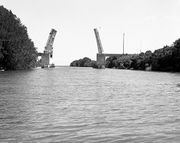
| Info:Haulover Canal West | Haulover Canal West | 2963F3 | Canal | Indian River | Brevard | 28.73004,-80.76122 | Lying within Kennedy Space Center, Haulover Canal connects to the Indian River lagoon near the former town of Allenhurst, Florida. Dug in 1887 by the Florida Coast Line Canal and Transportation Co., Haulover Canal is maintained by the US Army Corps of Engineers as a part of the Atlantic Intracoastal waterway. It's shores are maintained by the US Fish and Wildlife Service as a part of Merritt Island National Wildlife Refuge. |
Haulover Canal | Admin | 20210521052720 | ||||
| Info:Horse Creek | Horse Creek | 3081 | Creek | Indian River | Brevard | 28.16881,-80.64335 | Horse Creek is located north of Eau Gallie in Brevard County, Florida. |
Admin | 20210519062706 | |||||
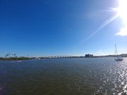
| Info:Indian River | Indian River | 2963B1 | Lagoon | Indian River | Brevard | 28.15337,-80.62511 | Indian River (Rio de Ais) is a 121 mile long lagoon spanning five counties on Florida's East Coast. From it's northern boundary in Brevard County, the lagoon ranges south through Indian River, St. Lucie and Martin, to it's southern boundary at Jupiter Inlet in Palm Beach County. Indian River is the largest lagoon basin in the Indian River Lagoon National Estuary. |
Indian River | Admin | 20210425105341 | ||||
| Info:Kid Creek | Kid Creek | 3115 | Creek | Indian River | Brevard | 27.96091,-80.53941 | Kid Creek is a freshwater tributary of the Indian River lagoon located near Valkaria, Florida. |
Admin | 20210519070249 | |||||
| Info:Max Hoeck Back Creek | Max Hoeck Back Creek | Creek | Mosquito Lagoon | Brevard | 28.64983,-80.64009 | Max Hoeck Back Creek lies at the southern end of Mosquito Lagoon, within the Merritt Island National Wildlife Refuge at Kennedy Space Center. |
Admin | 20210516090755 | ||||||
| Info:Mosquito Lagoon | Mosquito Lagoon | Lagoon | Mosquito Lagoon | Volusia | 28.83656,-80.79413 | Mosquito Lagoon (Los Mosquitos) is a 28 mile long, 36,000 acre, brackish water lagoon bounded by Ponce de Leon Inlet, Merritt Island National Wildlife Refuge, Canaveral National Seashore and Kennedy Space Center (KSC). |
Mosquito Lagoon | Admin | 20210425103429 | |||||
| Info:Mullet Creek | Mullet Creek | 5003D1 | Creek | Indian River | Brevard | 27.91046,-80.5149 | Mullet Creek is located in Grant, Florida. |
Admin | 20210519072413 | |||||
| Info:Ponce de Leon Inlet | Ponce de Leon Inlet | Inlet | Mosquito Lagoon | Volusia | 29.0765,-80.91893 | Ponce de Leon Inlet is a natural opening in Florida's East Coast barrier island connecting the north end of Mosquito Lagoon and the south end of Halifax River to the Atlantic Ocean. |
Ponce_Inlet_Lighthouse_from_top05.jpg | Ponce de Leon Inlet | Admin | 20210516090112 | ||||
| Info:Sykes Creek | Sykes Creek | 3044B | Creek | Banana River | Brevard | 28.38496,-80.68945 | Sykes Creek drains southward down the middle of Merritt Island, Florida to the Banana River lagoon. |
Admin | 20210502075104 | |||||
| Info:Trout Creek | Trout Creek | 3119 | Creek | Indian River | Brevard | 27.93708,-80.52908 | Trout Creek is located near Grant, Florida |
Admin | 20210519070733 | |||||
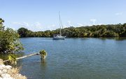
| Info:Turkey Creek | Turkey Creek | 3098A | Creek | Indian River | Brevard | 28.03841,-80.57955 | Turkey Creek, a freshwater tributary of the Indian River, is located in Palm Bay, Florida. |
Turkey_Creek_Palm_Bay_Fl_ckern.jpg | Admin | 20210519065135 | ||||
| Info:Turnbull Creek | Turnbull Creek | 29763F3 | Creek | Indian River | Brevard | 28.79847,-80.85097 | Turnbull Creek, located in Scottsmoor, Florida, is the northernmost boundary of the Indian River lagoon. |
Admin | 20210516201926 |
