IRLNews:Indian River Lagoon Basin Management Action Plans Adopted
North Indian River Lagoon
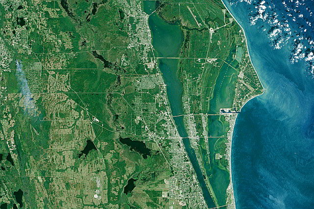
The North Indian River Lagoon Subbasin extends from Turnbull Creek in Volusia County to the Melbourne Causeway in Brevard County.
- 2021 North Indian River Lagoon Basin Management Action Plan (PDF 151pp 7.4MB)
- NIRL BMAP Final Order 2021 (PDF 8pp 2.35MB)
Central Indian River Lagoon
The Central Indian River Lagoon Subbasin extends from the Melbourne Causeway in Brevard County to Fort Pierce Inlet, and includes the areas drained by the Fort Pierce Farms Canal network and the C-25 Canal.
- 2021 Central Indian River Lagoon Basin Management Action Plan (PDF 202pp 4.7MB)
- CIRL BMAP Final Order 2021 (PDF 8pp 2.35MB)
Banana River Lagoon
The Banana River lagoon is located between the barrier island communities of the City of Cape Canaveral to Indian Harbour Beach and Merritt Island, and connects to the IRL at its south end. The BRL has a limited outlet to the Atlantic Ocean through the lock at Port Canaveral. The BRL subbasin is a “negative estuary,” characterized by low freshwater inflows and poor flushing, resulting in high water residence time.
- 2021 Banana River Lagoon Basin Management Action Plan (PDF 116pp 6MB)
- BRL BMAP Final Order 2021 (PDF 8pp 2.36MB)
What is a Basin Management Action Plan?
A basin management action plan (BMAP) is a framework for water quality restoration that contains local and state commitments to reduce pollutant loading through current and future projects and strategies.
BMAPs contain a comprehensive set of solutions, such as permit limits on wastewater facilities, urban and agricultural best management practices, and conservation programs designed to achieve pollutant reductions established by a total maximum daily load (TMDL).
These broad-based plans are developed with local stakeholders and rely on local input and commitment for development and successful implementation. BMAPs are adopted by Florida Department of Environmental Protection Secretarial Order and are legally enforceable. (FDEP)

