Indian River Lagoon Estuary
The Indian River Lagoon (IRL) National Estuary is the most bio-diverse natural habitat in North America.[1]
About the Indian River Lagoon Estuary
Covering 40% of Florida's East Coast, the 156 mile long[1] Indian River Lagoon (IRL) Estuary merges the freshwater of 5 rivers and the saltwater of 4 ocean inlets into 3 major brackish water lagoons. From it's northern end at Volusia's Ponce de Leon Inlet, the estuary spans across 6 Florida counties, to meet it's southern boundary at Palm Beach County's Jupiter Inlet. The IRL Estuary contains 5 State Parks, 4 U.S. National Wildlife Refuges, a National Seashore, an Intracoastal Waterway, an Air Force base and a National Space Center.
Because the IRL estuary is located in an area where tropical and temperate climates meet, it's flora and fauna species include native subtropical and tropical residents, plus many migratory winter visitors. The estuary's saltwater inlets and freshwater tributaries blend together to form the lagoon's brackish water, which provides an unique habitat where aquatic plants and animals, from both water sources, can reside. The estuary's geology creates many diverse natural habitats, from sea grass flats and mangrove shorelines to inland forests, the accommodates a vast array of plant and animal species. Home to more than 2,100 plants and 2,200 animals, the is the most bio-diverse habitat in North America.[1]
In 1990, the Indian River Lagoon was chosen as an Estuary of National Significance and assigned to the National Estuary Program (NEP) by the United States Environmental Protection Agency (EPA). Florida's St. Johns Water Management District (SJWMD) was the original local steward, and since 2015 the Indian River Lagoon National Estuary Program (IRLNEP) has been overseen by a special district of the State of Florida, the IRL Council.[2]
Geography
Averaging only 4' in depth and .5 to 5 miles wide, the Indian River Lagoon National Estuary covers 2,284 square miles with a surface water area of 353 square miles.[1] The Mosquito, Banana River, and Indian River lagoons are the three main water bodies in the IRL Estuary. Despite being named as rivers they are not, the brackish water lagoon's do not have a current flow; their waters are anly moved by wind and a minor tidal flow.
From it's northern boundary at Volusia's Ponce De Leon Inlet, the Indian River Lagoon National Estuary begins at the north tip of Mosquito Lagoon, then enters Brevard County and connects to the Indian River through Haulover Canal. Mosquito Lagoon is bounded on the west by the Merritt Island National Wildlife Refuge (NWR), Playalinda National Seashore on the east, and Kennedy Space Center on the south.
The Banana River lagoon begins at Banana Creek, near Titusville, spans south thru the Kennedy Space Center, and merges with the Indian River at the southern tip of Merritt Island, Dragon's Point. The middle of the Banana River lagoon lies in the Kennedy Space and is closed to public access. At KSC's southern border, the lagoon has minor saltwater input when the Port Canaveral Locks open, to allow seagoing vessels access to the Banana River, and through Merritt Island's Canaveral Barge Canal, to reach the Intracoastal Waterway (ICW) on the Indian River.
From it's northern end at Brevard's Scottsmoor, the 121 mile long Indian River extends southward thru five counties. It connects with the Atlantic Ocean at Sebastian, St. Lucie, Fort Pierce, and Jupiter inlets. Lake Okeechobee connects to the Indian River via the Okeechobee Waterway and Saint Lucie County's St. Lucie River at the Indian River Lagoon National Estuary's southern boundary, Martin County's Sewall's Point.
Habitat
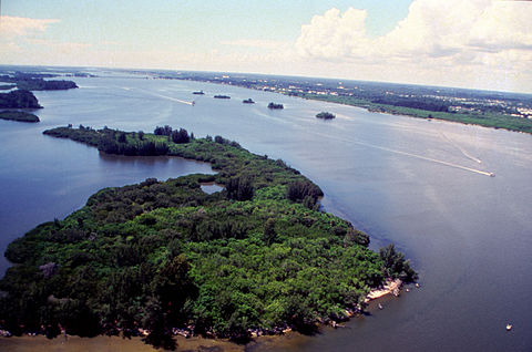
The estuary's tributaries, spoil islands, salt marshes, sea grass flats, oyster bars, mangroves, shorelines, and inland forests provide diverse natural habitats for both aquatic and terrestrial plants and animals.
Aquatic creatures such as alligator, turtle, dolphin, manatee, fresh and saltwater fish reside in the shallow brackish water. In the Merritt Island National Wildlife Refuge, a world class birding destination, many types of shorebirds, waterfowl and wading birds, like the roseate spoonbill, are found feeding on shrimp, crustaceans and mollusks near the shorelines. Inland birds of prey including hawks and eagles feed on inland reptiles and rodents or visit the lagoon to feast on it's many fish species. Residing higher up in the palmetto and pine trees the terrestrial animals include wild boar, panther, bobcat, deer, bobcat, raccoons, opossum, armadillo and gopher turtles.
Flora
Seagrass is a critical component to the overall health of the lagoon. By 1990, it had surpassed levels reached in 1943. The lagoon also contains night-blooming cereus.
Fauna
The lagoon contains 35 species listed as threatened or endangered — more than any other estuary in North America.[1] The lagoon has about 3,500 resident species of plants and animals.[3] It serves as a spawning and nursery ground for different species of oceanic and lagoon fish and shellfish. Nearly 1/3 of the nation's manatee population lives here or migrates through the Lagoon seasonally. Red Drum, Spotted sea trout, Common snook, and Tarpon are the main gamefish in the Titusville area of the lagoon system. Between 200 and 800 Bottlenose dolphins (Tursiops truncatus) also live in the Indian River Lagoon.[4]
Nine-banded armadillos comprise one of the 34 mammals in the area. It is a 1920s immigrant from the Southwestern United States. Avians include the American kestrel, Reddish egret and the Roseate spoonbill. Butterflies include the Polydamas swallowtail.
Indian River Lagoon is abundant with bioluminescent dinoflagellates in the summer and ctenophore in the winter.
History
During glacial periods, the ocean receded. The area that is now the lagoon was grassland, 30 miles from the beach. When the glacier melted, the sea rose. The lagoon remained as captured water.[5]
The indigenous people who lived along the lagoon thrived on its fish and shellfish. This was determined by analyzing the middens they left behind, piled with refuse from clams, oysters, and mussels.[5]
The Indian River Lagoon was originally known on early Spanish maps as the Rio de Ais, after the Ais Indian tribe, who lived along the east coast of Florida. An expedition in 1605 by Alvero Mexia resulted in the mapping of most of the lagoon. Original place names on the map included Los Mosquitos (the Mosquito Lagoon and the Halifax River), Haulover (current Haulover Canal area), Ulumay Lagoon (Banana River) Rio d' Ais (North Indian River), and Pentoya Lagoon (Indian River Melbourne to Ft. Pierce)
Early European settlers drained the swamps to raise pineapples and citrus. They dug canals discharging fresh water into the lagoon, five times the historical volume.
Prior to the arrival of the railroad, the river was an essential transportation link.
In 1896 and 1902, there were fish kills in the lagoon from gas from the muck below.
The advent of the automobile, starting in the 1930s, resulted in causeways which diverted the sluggish flow of the waterway. Huge population influx resulted in sewage, and stormwater runoff from roadways, polluting the lagoon.[5]
From 1989 to 2013, the population along the lagoon increased 50% to 1.6 million people.
- ↑ 1.0 1.1 1.2 1.3 1.4 An Introduction to a Natural Treasure
- ↑ Indian River Lagoon National Estuary Program
- ↑ Indian River Lagoon Species Inventory Data Base from Smithsonian Marine Station at Fort Pierce
- ↑ BOTTLENOSE DOLPHIN (Tursiops truncatus) Indian River Lagoon Estuarine System Stock
- ↑ 5.0 5.1 5.2 A History of the Lagoon
River modifications
In 1916, the St. Lucie Canal (C-44) diverts excess nutrient-rich water from Lake Okeechobee into the South Lagoon. While this helps prevent life-threatening flooding in the Okeechobee area, it creates toxic blooms after entering the Lagoon, a threat to flora, fauna, and humans. This situation is proving difficult to address in the 21st century.
From 1913 to 2013, activity by humans has increased the watershed for the lagoon from 572000 to 1400000 acres increasing runoff of freshwater and nutrients from farms. Both have been detrimental to lagoon health.
Mangroves help prevent shore erosion and provide critical habitat for marine life. Between the 1940s and 2013, 85% of them had been removed for housing development.
In 1990, the Florida Legislature passed the Indian River Lagoon Act, requiring most sewer plants to stop discharging into the lagoon by 1996. Some sports fish rebounded in population in the 1990s when gill nets were banned and pollution in the lagoon was reduced. In 1995 the seagrass covered over 100000 acres.
The 1993–1996 data base used to track the movement of water through the St. Lucie Estuary and into Indian River Lagoon is described in Smith (2007). This includes daily mean discharge rates for the 16 gauged canals emptying into the St. Lucie Estuary and Indian River Lagoon, predicted shelf tides, and wind speeds and directions recorded along the west side of the lagoon at about 27°32'N (corresponding to Segment 11 of the model).
In 2007, concerns were raised about the future of the lagoon system, especially in the southern half where frequent freshwater discharges seriously threatened water quality, decreasing the salinity needed by many fish species, and have contributed to large algae blooms promoted by water saturated with plant fertilizers. In the mid 1990s, the lagoon has been the subject of research on light penetration for photosynthesis in submerged aquatic vegetation.
In 2010, 3300000|lb of nitrogen and 475000|lb of phosphorus entered the lagoon.
In 2011, a superbloom of phytoplankton resulted in the loss of 32000 acres of lagoon seagrass. In 2012, a brown tide bloom fouled the northern lagoon. The county has approval for funds to investigate these unusual blooms to see if they can be prevented.
Catches of blue crabs dropped unevenly from 4265063 lb in 1987 to 389,795 lb in 2012, but with high catches in 1998, 1991, alternating with low catch years. These crabs require 2% salt content in the water to survive. A drought increases the salt content and heavy rainfall decreases it. Both of these conditions have recurred over the past decades and are believed to have had an adverse effect on the crab population.
In 2013, algae blooms and loss of sea grass destroyed all gains. In 2013, four major problems with lagoon water quality were identified. 1) Excess nitrogen and phosphorus from runoff from the application of fertilizer; 2) an estimated 8 to 11% septic tank failures of tens of thousands of septic tanks in the county. 3) Muck from construction, farming, erosion and dead plants find their way to the bottom of the lagoon, preventing growth and consuming vital oxygen essential to marine flora and fauna; 4) Invasive species, including the Asian green mussel, South American charru mussel, and the Australian spotted jellyfish, eat clams and fish larvae.
In 2016, there were an estimated 300,000 septic tanks in the five-county area bordering the Lagoon.[1]
At one time, sewer plants were worse polluters. In 1986, there were 46 sewer plants along the 156 mile lagoon. They discharged about 55000000 gallons daily into the estuary. The state ended most sewer plant pollution by 1995.
In 2018, lagoon health is better near ocean inlets. Pollution is worse in areas near no inlets, such as the Mosquito Lagoon, North IRL, and the Banana River.
Economy
According to the Florida Oceanographic Society, nearly 1 million people live and work in the Indian River Lagoon region. The Lagoon accounts for $300 million in fisheries revenues, includes a $2.1 billion citrus industry, and generates more than $300 million in boat and marine sales annually.
In 2007, visitors spent an estimated 3.2 million person-days in recreation on the lagoon.
In 2008, Hazen and Sawyer, P.C. submitted a report titled "Indian River Lagoon Economic Assessment and Analysis Update" to the Indian River Lagoon National Estuary Program, St. Johns River Water Management District. The report described the estimated 2007 recreational uses and economic value of the Indian River Lagoon to residents and visitors of the five counties that comprise the Lagoon system. The sum of recreational expenditures and recreational use value was estimated at $2.1 billion.
Web Links
- NOAA Estuary Education Kit
- Indian River Lagoon Watershead from the Florida Department of Environmental Protection
- Indian River Lagoon Species Inventory
- From the Water: Healing our Lagoon: a 2015 series of Florida Today articles.