File:Saltmarsh.jpg
From Indian River Lagoon Project
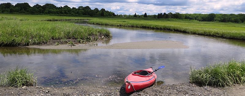
Revision as of 09:06, July 14, 2024 by Admin (talk | contribs) (Salt marsh within Narragansett Bay National Estuarine Research Reserve. Salt marshes are coastal wetlands which are flooded and drained by tides. See: Glossary:Salt marsh Source: https://oceanservice.noaa.gov/facts/saltmarsh.jpg)

Size of this preview: 800 × 313 pixels. Other resolution: 960 × 376 pixels.
Original file (960 × 376 pixels, file size: 140 KB, MIME type: image/jpeg)
Salt marsh within Narragansett Bay National Estuarine Research Reserve. Salt marshes are coastal wetlands which are flooded and drained by tides.
See: Glossary:Salt marsh
File history
Click on a date/time to view the file as it appeared at that time.
| Date/Time | Thumbnail | Dimensions | User | Comment | |
|---|---|---|---|---|---|
| current | 09:06, July 14, 2024 | 960 × 376 (140 KB) | Admin (talk | contribs) | Salt marsh within Narragansett Bay National Estuarine Research Reserve. Salt marshes are coastal wetlands which are flooded and drained by tides. See: Glossary:Salt marsh Source: https://oceanservice.noaa.gov/facts/saltmarsh.jpg |
You cannot overwrite this file.
File usage
The following page uses this file: