Link:Florida Water Resource Monitoring Catalog: Difference between revisions
mNo edit summary Tag: Reverted |
No edit summary Tag: Manual revert |
||
| Line 13: | Line 13: | ||
Sample sites represented in the catalog are located throughout the state of Florida. They monitor inland and coastal resources, water bodies (lakes, streams, bays, estuaries, oceans) and groundwater resources. Geographic Information Systems (GIS) technology is used by the Catalog to map sample sites to specific locations and to allow spatial searches. | Sample sites represented in the catalog are located throughout the state of Florida. They monitor inland and coastal resources, water bodies (lakes, streams, bays, estuaries, oceans) and groundwater resources. Geographic Information Systems (GIS) technology is used by the Catalog to map sample sites to specific locations and to allow spatial searches. | ||
|Region=Florida | |Region=Florida | ||
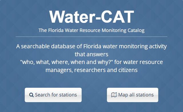
|Screenshot= | |Screenshot=Florida Water Catalog.jpg | ||
|Type=Database | |Type=Database | ||
|Topic=Water Quality Resources | |Topic=Water Quality Resources | ||
Revision as of 17:48, March 24, 2023
The goal of the Catalog is to help water resource managers better protect, preserve, manage and restore water resources in the state of Florida, by making it easier for them to coordinate water resource monitoring efforts and share information. The Catalog can also help researchers by letting them know what data have been collected, where they were collected, and how to acquire the data for their own analysis. Members of the public can use the Catalog to find out about monitoring activities being performed in their communities.
The Catalog project is sponsored by the Florida Department of Environmental Protection (DEP), with funding from the U.S. Environmental Protection Agency . The Florida Water Resource Monitoring Council, created and coordinated by the DEP, is composed of stakeholders from many organizations and disciplines that participate in water resource monitoring and management statewide. Members of the Council provided guidance during the design and development of the Catalog. Design and implementation of the database and online tools to access it are being performed by the USF Water Institute at the University of South Florida in Tampa.
The Catalog project was initially proposed in 2008 as part of the Council's Monitoring-Coordination Action Plan. Development was initiated in May 2013 and is substantially complete. It is anticipated that the Catalog will be retained indefinitely, with ongoing support for new metadata submissions, routine maintenance and scheduled updates.
Sample sites represented in the catalog are located throughout the state of Florida. They monitor inland and coastal resources, water bodies (lakes, streams, bays, estuaries, oceans) and groundwater resources. Geographic Information Systems (GIS) technology is used by the Catalog to map sample sites to specific locations and to allow spatial searches.

