Category:Region: Difference between revisions
From Indian River Lagoon Project
mNo edit summary |
mNo edit summary |
||
| Line 2: | Line 2: | ||
<big>''Spanning 6 counties, the 156 mile long [[Indian River Lagoon Estuary]] covers 40% of Florida's East Coast.''</big> | <big>''Spanning 6 counties, the 156 mile long [[Indian River Lagoon Estuary]] covers 40% of Florida's East Coast.''</big> | ||
==The Indian River Estuary Locale== | ==The Indian River Estuary Locale== | ||
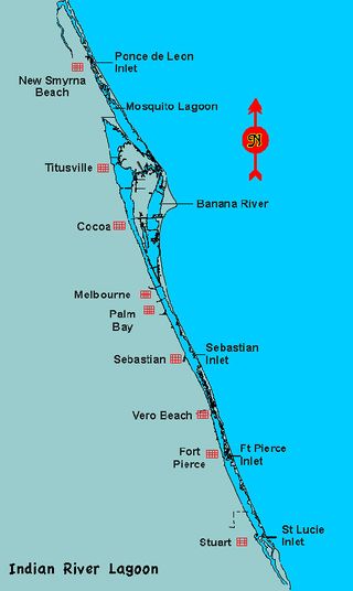
[[File:Indian_river_lagoon_map.jpg|border| | [[File:Indian_river_lagoon_map.jpg|border|320px|right|Indian River Lagoon Map]] | ||
The national estuary is located in six Florida counties:<br/> | The national estuary is located in six Florida counties:<br/> | ||
Revision as of 15:49, October 27, 2019
Spanning 6 counties, the 156 mile long Indian River Lagoon Estuary covers 40% of Florida's East Coast.
The Indian River Estuary Locale
The national estuary is located in six Florida counties:
no subcategories
Subcategories
This category has the following 9 subcategories, out of 9 total.

