Info:Max Brewer Bridge: Difference between revisions
From Indian River Lagoon Project
mNo edit summary |
mNo edit summary |
||
| Line 12: | Line 12: | ||
|Built=2010 | |Built=2010 | ||
|FDOT=700227 | |FDOT=700227 | ||
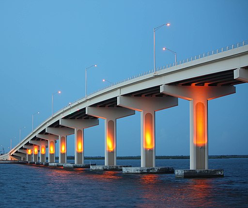
|Description=Completed in 2010, the 3,207' long, 65' high A. Max Brewer Bridge connects the City of Titusville to Merritt Island providing access to the Kennedy Space Center via SR406. Includes a fishing pier and boat ramps on the west side and a 20' observation deck at the crest. This bridge is a good observation site for Kennedy Space Center, when it is closed to vehicle traffic. | |Description=Completed in 2010, the 3,207' long, 65' high A. Max Brewer Bridge connects the City of Titusville to Merritt Island providing access to the Kennedy Space Center via SR406. Includes a fishing pier and boat ramps on the west side and a 20' observation deck at the crest. This bridge is a good observation site for Kennedy Space Center, when it is closed to vehicle traffic. | ||
|Article=Max Brewer Bridge | |Article=Max Brewer Bridge | ||
|Image=image-max-brewer-bridge.jpg | |Image=image-max-brewer-bridge.jpg | ||
Revision as of 08:39, December 7, 2019
Max Brewer Bridge | ||||
|---|---|---|---|---|
| Completed in 2010, the 3,207' long, 65' high A. Max Brewer Bridge connects the City of Titusville to Merritt Island providing access to the Kennedy Space Center via SR406. Includes a fishing pier and boat ramps on the west side and a 20' observation deck at the crest. This bridge is a good observation site for Kennedy Space Center, when it is closed to vehicle traffic. Article | ||||
| Waterway: Indian River | Road: SR406 | |||
| City: Titusville | County: Brevard | |||
| Type: Segmental Span | Builder:DRMP | |||
| DOT: 700227 | L: 3,207' | H: 65' | Built: 2010 | |
Location: 28.61758, -80.80274
| ||||
