File:Map-merritt-island-nwr-management.jpg
From Indian River Lagoon Project
Size of this preview: 452 × 600 pixels. Other resolution: 480 × 637 pixels.
Original file (480 × 637 pixels, file size: 209 KB, MIME type: image/jpeg)
Summary
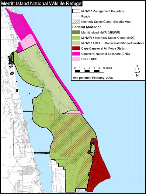
This map shows the many United States Government agencies involved in the management of the Merritt Island National Wildlife Refuge.
https://www.fws.gov/uploadedFiles/MIWR_%20CCP(1).pdf page 22
File history
Click on a date/time to view the file as it appeared at that time.
| Date/Time | Thumbnail | Dimensions | User | Comment | |
|---|---|---|---|---|---|
| current | 21:30, November 19, 2019 | | 480 × 637 (209 KB) | Admin (talk | contribs) | This map shows the many United States Government agencies involved in the management of the Merritt Island National Wildlife Refuge. https://www.fws.gov/uploadedFiles/MIWR_%20CCP(1).pdf page 22 |
You cannot overwrite this file.
File usage
The following page uses this file: