Mosquito Lagoon: Difference between revisions
m (→Documents) |
m (→Ecosystem) |
||
| Line 31: | Line 31: | ||
<div class="irlcontentmiddle"> | <div class="irlcontentmiddle"> | ||
==Ecosystem== | ==Ecosystem== | ||
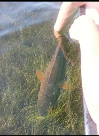
Red_Drum_Redfish_Seagrass_Mosquito_Lagoon.jpg | |||
[[File:Red_Drum_Redfish_Seagrass_Mosquito_Lagoon.jpg|320px|thumb|right|alt=Redfish in Mosquito Lagoon seagrass]] | |||
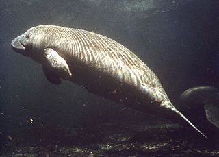
[[File:West_Indian_Manatee.jpg|320px|thumb|right|alt=Florida Manatee|Florida Manatee]] | [[File:West_Indian_Manatee.jpg|320px|thumb|right|alt=Florida Manatee|Florida Manatee]] | ||
Mosquito Lagoon is located in a transition zone between the temperate province to the north and the warm subtropical province to the south. The watershed contains many different habitats including shallow [[seagrass]] flats, oyster beds, salt marshes, [[mangrove]] shorelines, and upland forests. | Mosquito Lagoon is located in a transition zone between the temperate province to the north and the warm subtropical province to the south. The watershed contains many different habitats including shallow [[seagrass]] flats, oyster beds, salt marshes, [[mangrove]] shorelines, and upland forests. | ||
Revision as of 05:55, June 3, 2023
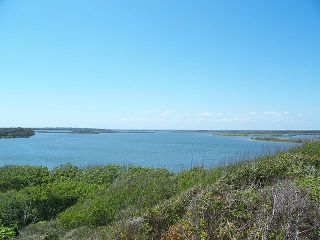
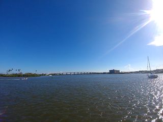
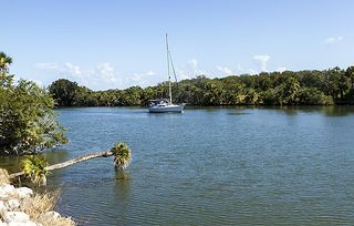
Mosquito Lagoon (Los Mosquitos) is a 28 mile long, 36,000 acre, brackish water lagoon located in Brevard and Volusia counties on Florida's East Coast. The bar-built estuary covers an estimated 111 square mile (288.5 km2) area of which 53% is open water of 4ft average depth, 15.8% is barrier island and 31.2% is uplands.[1]
Recognized by the EPA's National Estuary Program as an Estuary of National Significance, Mosquito Lagoon is one of three main lagoons in the Indian River Lagoon National Estuary. It is an acclaimed spotted seatrout and red drum fishery, and a popular destination for anglers, kayakers, and wildlife watchers.
Mosquito Lagoon is one of the largest undeveloped and primitive coastal zones remaining on Florida's East Coast. Unfamiliar boaters are advised to carry a GPS device when venturing past the marked channels.
Location
Mosquito Lagoon extends from Volusia County's Ponce de Leon Inlet to Max Hoeck Back Creek in Brevard's Kennedy Space Center.
Coordinates: 28°47'51.1"N 80°46'45.2"W GIS:28.797532,-80.77922
Geology
Development of the barrier island forming the eastern boundary of Mosquito Lagoon began approximately 7,000 years ago.[2]
Five tidal inlets once connected the lagoon with the Atlantic Ocean.[3] These inlets were located at the mangrove island clusters found between Max Hoeck Creek and Turtle Mound. The inlets appear to be older in age as you progress southward. The last invasion of new quartz sand to the lagoon occurred about 1500 years ago and so the youngest inlet was at Turtle Mound and dates to approximately 500 A.D. The geological strata for these old inlet areas contain oysters indicating that the area was open to tidal flushing.[4][2]
Mosquito Lagoon was not connected to the Indian River lagoon until the construction of Haulover Canal in 1854.[2]
Ecosystem
Red_Drum_Redfish_Seagrass_Mosquito_Lagoon.jpg
Mosquito Lagoon is located in a transition zone between the temperate province to the north and the warm subtropical province to the south. The watershed contains many different habitats including shallow seagrass flats, oyster beds, salt marshes, mangrove shorelines, and upland forests.
The brackish water lagoon has a temperate climate and varied habitat that make it an ideal home for plant and animal species from both fresh and salt water environments. This unique ecosystem makes Mosquito Lagoon part of one of the most diverse estuarine areas in the United States.
Mosquito Lagoon is dominated by shallow flats that support the growth of submerged aquatic vegetation including manatee grass,(Syringodium filiforme), shoal grass (Halodule wrightii), widgeon grass (Ruppia maritima), and various macroalgae such as Gracilaria, Caulerpa, Sargassum, and Acanthophora.
Mosquito Lagoon shorelines are dominated by white (Laguncularia racemosa) and black (Avicennia germinans) mangrove. This region is the mangrove's northern range limit and occasional winter freezes have significantly impacted their populations.
Fauna in the lagoon is also dominated by species such as mullet (Mugil cephalus), spotted sea trout (Cynoscion nebulosus), red drum (Sciaenops ocellatus), sea catfish (Arius felis), and blue crabs (Callinectes sapidus) to name a few. Subtropical species are present but are less prevalent than in the southern portion of the Indian River Lagoon System.[2]
The restricted circulation and often hypersaline conditions of Mosquito Lagoon lead to a reference to it as a "miniature ocean environment" whereby some fish species remain in the lagoon rather than migrate offshore to complete their life cycles.[2]
The bottlenose dolphin (Tursiops truncatus) is by far the most commonly sighted marine mammal in the Mosquito Lagoon followed by the West Indian manatee (Trichechus manatus). Many are year-round residents of the lagoon due to its temperate climate and salinity.
Manatees are seen in the lagoon and use it as a travel corridor to other sections of their east coast habitats, at least since the Haulover Canal was built in 1854. However, aerial surveys over sections of the lagoon indicate that, despite its relatively undisturbed condition, the lagoon is not an area with particularly high numbers of manatees.[5]
Shane commented that the counts of manatees in Mosquito Lagoon and northern Indian River were extremely low and contrasted sharply with those from Banana River and Indian River lagoons. Her surveys indicated that manatees in Mosquito Lagoon were typically seen in the ICW or along the spoil islands near the ICW. She speculated that manatees don't use the lagoon to much extent because of the lack of freshwater sources and dredged areas.[5]
Management
About 82% of Mosquito Lagoon is on federal property and co-managed by federal agencies.
About 65% of the lagoon lies on Kennedy Space Center property and is managed by the Fish and Wildlife Service (FWS) as part of the Merritt Island National Wildlife Refuge.
Another 17% is managed by the National Park Service as part of Canaveral National Seashore.
Additionally, the lagoon's Haulover Canal and Bridge are maintained and operated by the U.S. Army Corps of Engineers (USACE) as a part of the Intracoastal Waterway (ICW).[2]
Mosquito Lagoon is recognized as an "Outstanding Florida Water" by the Florida Legislature (FL Rule 62-302.700(9)) with 4,740 acres in the northern lagoon managed by Florida's Fish and Wildlife Conservation Commission (FWC) as the Mosquito Lagoon Aquatic Preserve.[2] Mosquito Lagoon is also recognized as an "estuary of national significance" by the EPA's Indian River Lagoon National Estuary Program.
See Also: Mosquito Lagoon Organizational Chart
Mosquito Control
Mosquito Lagoon lies within two mosquito control districts, Brevard and Volusia, and is managed differently within each. These two agencies are responsible for most of the mosquito control studies that have occurred in the lagoon. Saltmarsh mosquito control and impoundment studies have been conducted[6] in small sections of the Mosquito Lagoon.[2]
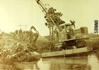
The Brevard County Mosquito Control District (BCMCD) was incorporated in 1937 and spraying to control mosquito populations was begun at that time. In the late 1950's BCMCD, in conjunction with various other agencies, implemented the construction of mosquito control impoundments. These impoundments were constructed up until 1972. At the present time, only maintenance measures are performed on these existing impoundments.[2]
Through the years various pesticides, larvicides, and other chemicals have been used in the attempt to control mosquito populations. As early as 1937 diesel was used, although in 1988 this was replaced by a chemical called Golden Bear which is a refined diesel oil that is used in considerably lower amounts. The main chemical used in Mosquito Lagoon since 1968 is the larvicide, Altosand. Brevard County rarely sprays in the Mosquito Lagoon.[2]
Volusia County Mosquito Control District (VCMCD) was also incorporated in 1937 when two smaller districts merged. In the 1920s and 1930s hand ditching began in the lagoon and was later replaced (1940's and 1950's) by draglines. Impoundments became popular in the 1960s and 1970s, although by the mid-1980s they were no longer in use in the lagoon (they were opened up). With the 1980s came rotary ditching, which is still in use now. The purpose of rotary ditching was for source reduction. Areas where mosquitoes were able to breed, like potholes, were connected to permanent sources of water. Not only did the water flood the moist ground that was needed for egg-laying but it allowed access for fish whose primary food source was mosquito larvae. In addition to these methods, insecticides were used that affected the individual stages of the mosquito lifecycle. Since 1978, the larvicide Altosid has been the primary chemical sprayed in the lagoon by VCMCD. Unlike BCMCD, Volusia County frequently sprays in the areas of Mosquito Lagoon that they manage.[2]
Conservation
1950-1970 has been described as the most serious period in the history of the Indian River Lagoon in terms of negative influences by humans with dramatic increases in agricultural and urban land use.[2]
Mosquito Lagoon was studied from an ecological standpoint beginning in the early 1970s (Mulligan and Snelson 1983, Schooley 1977, Snelson 1980,1983, Snelson and Bradley 1978, and Snelson et al. 1988). The data collected provided an inventory of species typically encountered in the past and information as to what habitats within the lagoon are important to certain species.[7][8] Some species require the direct use of several habitats in the lagoon during the various phases of their life cycles[9], thus demanding that proper connections between the habitats and the health of individual habitats remain intact.[2]
The high marshes along the southern end of Mosquito Lagoon were accessible to fishes until the 1950s. Over 92% of the mangrove and saltmarsh habitats along the Indian River were impounded for mosquito control, greatly impacting spot, channel bass, and striped mullet in the northern portion of the system.[2]
Channelization, ditching, filling, pesticide, and herbicide applications were common occurrences during what has been labeled as a period of "great environmental insult" when there was "virtually no concern for water quality".(Gilmore)[2]
The entire Indian River Lagoon system (IRL) is known to be a major contributor to the Florida fishing industry. Landings data showed that Mosquito Lagoon and the upper Indian River complex are the most productive areas for the northeast Florida coastal region.[10]
Pole and Troll Zone
The Pole & Troll Zones were developed with extensive input from anglers and are intended to improve the quality of flats fishing and reduce prop scarring. The two Pole & Troll Zones cover 3,143 acres of the 21,000 acre Mosquito Lagoon.
To be in compliance with the regulations of the Zones, internal combustion engines must be off, (except in the posted channels) and boats drafting more than 12" at rest may not enter. Boats that enter the zone must switch to a non-internal combustion power source such as electric trolling motors, polling, or paddling. Pole & Troll Zones boundaries are posted with white or yellow buoys and the running channels are marked with red and green day markers.[11]
Video
Play a video or visit the Indian River Lagoon Project You Tube Channel - Mosquito Lagoon Video Playlist.
See Also
- Mosquito Lagoon Organization
- Mosquito Lagoon Organizational Chart
- Mosquito Lagoon Aquatic Preserve
- Haulover Canal
- Ponce de Leon Inlet
- Ponce de Leon Lighthouse Station
Web Links
Documents
- NPS - Mosquito Lagoon Water Quality (PDF 2pp 15KB)
- NASA - Mosquito Lagoon Environmental Resources Inventory Report 1992
- KSC - Environmental Impact Statement 2016 (PDF 700pp 21.2MB)
- FWS - Merritt Island National Wildlife Refuge Habitat Management Plan 2006 (PDF 240pp 3.7MB)
- FDEP - Mosquito Lagoon Aquatic Preserve Management Plan 2009 (PDF 184pp 8.1MB)
- Mosquito Lagoon Aquatic Preserve Management Plan 1990
- FWC - Management Plan for Mosquito Lagoon Marine Enhancement Center 2018 (PDF 171pp 3.6MB)
References
- ↑ Clapp, D. (1987). Overview of Physiographic and Surface Drainage Features, Chapter 1. In: Indian River Lagoon Joint Reconnaissance Report. Steward, J.S., and J.A. VanArman, (eds). p. 1-27. Ref. 150.
- ↑ 2.00 2.01 2.02 2.03 2.04 2.05 2.06 2.07 2.08 2.09 2.10 2.11 2.12 2.13 2.14 NASA 1992 Mosquito Lagoon Environmental Resources Inventory Report
- ↑ Mehta, A.J., and H.K. Brooks. (1973). Mosquito Lagoon Barrier Beach Study. Shore and Beach 41(2):26-34. Ref. 142.
- ↑ Snelson, F.F., Jr. (1983). Ichthyofauna of the Northern Part of the Indian River Lagoon System, Florida. Fla. Sci. 46(3/4):187-206. Ref. 52.
- ↑ 5.0 5.1 Shane, S.H. (1983). Abundance, Distribution, and Movements of Manatees (Trichechus manatus)in Brevard County, Florida. Bull. Mar. Sci. 33(1):1-9. Ref. 79.
- ↑ Montague, C.L., A.V. Zale, and H.F. Percival. (1984). Photographic Analysis of Natural and Impounded Salt Marsh in the Vicinity of Merritt Island, Florida. Tech. Rept. #11 Fla. Coop. Fish & Wildl. Res. Unit & Systems Ecol. & Energy Analysis Prog. 19 pp. Ref.131
- ↑ Schooley, J.K. (1977). Factors Affecting the Distribution of the Nearshore Fishes in the Lagoonal Waters of the Indian River, Florida. Univ. Fla. Masters Degree Thesis. 165pp. Ref. 63.
- ↑ Snelson, F.F., Jr. (1980). A Continuation of Base-Line Studies for Environmentally Monitoring Space Transportation Systems (STS) at John F. Kennedy Space Center. Vol. III of IV. Part 1 : Ichthyological Studies (Lagoonal Waters). KSC TR 51-2, Vol. III, Part 1, NASA Contract Rept. # 163122. 435 pp. Ref. 100.
- ↑ Gilmore, R.G., P.A. Hastings, and D.J. Herrema. (1983). Ichthyofaunal Additions to the Indian River Lagoon and Adjacent Waters, East-Central Florida. Fla. Sci. 46(1):22-30.Ref. 19.
- ↑ Durako, M.J., M.D. Murphy, and K.D. Haddad. (1988). Florida Marine Research Publications: Assessment of Fisheries Habitat: Northeast Florida. Fla. Dept. Nat. Resour., Bureau of Mar. Res. #45. 51 pp. Ref. 5.
- ↑ FWS - Merritt Island NWR Fishing

