Turtle Mound: Difference between revisions
mNo edit summary |
mNo edit summary |
||
| Line 1: | Line 1: | ||
<div class="irlbody" | <div class="irlbody"> | ||
{{IRL header estuary|cat=}} | |||
{{IRL header}} | |||
<p class="irlsubtitle">Turtle Mound was saved in 1924 by The Florida State Historical Society, who purchased Canaveral National Seashore for $8,000.</p> | <p class="irlsubtitle">Turtle Mound was saved in 1924 by The Florida State Historical Society, who purchased Canaveral National Seashore for $8,000.</p> | ||
<div class="irlcontenttop"><!-- Content Top div --> | <div class="irlcontenttop"><!-- Content Top div --> | ||
[[File:turtle-mound-1930.jpg|420px|thumb|left|Turtle Mound 1930]] | [[File:turtle-mound-1930.jpg|420px|thumb|left|Turtle Mound 1930]] | ||
Dating back to 1200 AD (The Mississippian Period), Turtle Mound, in the [[Canaveral National Seashore]], is the tallest in Florida and the third tallest in North America. It is one of the most significant geographical sites on the east coast of the U.S. Historians estimate that it comprises 33,000 cubic yards of oyster shells, extends 600 feet along the Indian River and is 50 feet high. Dating back to prehistoric times, the mound was built by the Timucuan Indians, and served as a watch out point for enemies and approaching storms. | Dating back to 1200 AD (The Mississippian Period), Turtle Mound, in the [[Canaveral National Seashore]], is the tallest in Florida and the third tallest in North America. It is one of the most significant geographical sites on the east coast of the U.S. Historians estimate that it comprises 33,000 cubic yards of oyster shells, extends 600 feet along the Indian River and is 50 feet high. Dating back to prehistoric times, the mound was built by the Timucuan Indians, and served as a watch out point for enemies and approaching storms. | ||
[[File:TurtleMound1970 FPS1191.jpg|320px|thumb|right|Turtle Mound 1970]] | [[File:TurtleMound1970 FPS1191.jpg|320px|thumb|right|Turtle Mound 1970]] | ||
| Line 16: | Line 12: | ||
Today, the National Park Service at [[Canaveral National Seashore]] offers a fun .5 mile boardwalk hike to the top of Turtle Mound, with interpretive signs along the way. From the peak, visitors can see the great estuaries used by native people during the late-St. Johns period. The panoramic view of the Atlantic Ocean, Merritt Island, the [[Indian River]], and [[Mosquito Lagoon]] is spectacular, and one which was surely enjoyed by the prehistoric inhabitants of the area. | Today, the National Park Service at [[Canaveral National Seashore]] offers a fun .5 mile boardwalk hike to the top of Turtle Mound, with interpretive signs along the way. From the peak, visitors can see the great estuaries used by native people during the late-St. Johns period. The panoramic view of the Atlantic Ocean, Merritt Island, the [[Indian River]], and [[Mosquito Lagoon]] is spectacular, and one which was surely enjoyed by the prehistoric inhabitants of the area. | ||
</div | </div> | ||
<div class="irlcontentmiddle"> | |||
<div class="irlcontentmiddle" | |||
==Location== | ==Location== | ||
Coordinates: ( 28°55'50.2"N, 80°49'38.0"W ) | Coordinates: ( 28°55'50.2"N, 80°49'38.0"W ) | ||
{{#cargo_display_map:point=28.930607, -80.827227 |service=googlemaps|width=420px|zoom=10 |}} | {{#cargo_display_map:point=28.930607, -80.827227 |service=googlemaps|width=420px|zoom=10 |}} | ||
==Images== | ==Images== | ||
<gallery widths=380px> | <gallery widths=380px> | ||
| Line 35: | Line 27: | ||
File:TurtleMound1929 ge1157.jpg | File:TurtleMound1929 ge1157.jpg | ||
</gallery> | </gallery> | ||
==Video== | ==Video== | ||
{{#ev:youtube|RfRPBQw7E0A|420px|center}} | {{#ev:youtube|RfRPBQw7E0A|420px|center}} | ||
{{#ev:youtube|ecF7JZcpVQk|420px|center}} | {{#ev:youtube|ecF7JZcpVQk|420px|center}} | ||
</div><!-- End Content Middle div --> | </div><!-- End Content Middle div --> | ||
<div class="irlcontentbottom" | <div class="irlcontentbottom"> | ||
==Reading== | ==Reading== | ||
[[File:We-Will-Remember-Turtle-Mound.pdf|320px|center|border|page=2|We Will Remember Turtle Mound - Children's Book|link=https://sciences.ucf.edu/biology/ceelab/wp-content/uploads/sites/234/2019/07/We-Will-Remember-Turtle-Mound_-Uncovering-the-Past-and-Saving-the.pdf]] | [[File:We-Will-Remember-Turtle-Mound.pdf|320px|center|border|page=2|We Will Remember Turtle Mound - Children's Book|link=https://sciences.ucf.edu/biology/ceelab/wp-content/uploads/sites/234/2019/07/We-Will-Remember-Turtle-Mound_-Uncovering-the-Past-and-Saving-the.pdf]] | ||
| Line 54: | Line 41: | ||
* [https://www.nps.gov/nr/travel/geo-flor/34.htm Florida Historic Places - NPS] | * [https://www.nps.gov/nr/travel/geo-flor/34.htm Florida Historic Places - NPS] | ||
* [https://lostworlds.org/turtle-mound-1200-ad/ Turtle Mound - Lost Worlds] | * [https://lostworlds.org/turtle-mound-1200-ad/ Turtle Mound - Lost Worlds] | ||
==References== | ==References== | ||
<references /> | <references /> | ||
</div | </div> | ||
{{IRL footer estuary|cat=Historical Site}} | |||
</div> | |||
</div | |||
[[Category:Historical Site]] | [[Category:Historical Site]] | ||
[[Category:National Wildlife Refuge]] | [[Category:National Wildlife Refuge]] | ||
[[Category:Mosquito Lagoon]] | [[Category:Mosquito Lagoon]] | ||
[[Category:Volusia County Locale]] | [[Category:Volusia County Locale]] | ||
Revision as of 20:41, November 22, 2020
Turtle Mound was saved in 1924 by The Florida State Historical Society, who purchased Canaveral National Seashore for $8,000.

Dating back to 1200 AD (The Mississippian Period), Turtle Mound, in the Canaveral National Seashore, is the tallest in Florida and the third tallest in North America. It is one of the most significant geographical sites on the east coast of the U.S. Historians estimate that it comprises 33,000 cubic yards of oyster shells, extends 600 feet along the Indian River and is 50 feet high. Dating back to prehistoric times, the mound was built by the Timucuan Indians, and served as a watch out point for enemies and approaching storms.

Long before Juan Ponce de Leon sailed Florida’s east coast in 1513 searching for a “Fountain of Youth,”, Timucuan Indians lived here. They occupied this area 10,000 years ago as Nomadic hunters and gatherers. But although the Timucuans disappeared within 200 years of Ponce de Leon’s landing, victims of European infections and slavery, their shell mounds survived. Dr. Amos W. Butler, an Indian archaeologist, identified 22 mounds between Port Orange and Oak Hill in his publication “Observations on Some Shell Mounds on the Eastern Coast of Florida,” in 1917.[1]
However, virtually all 22 were destroyed for use as road material. Turtle Mound was saved in 1924 by The Florida State Historical Society which purchased Canaveral National Seashore for $8,000. Today it is a selected State Historic Memorial and in the National Park Service Register of Historic places.[2] Observable seven miles out to sea, Turtle Mound has been a navigational aid since the 1500s.
Today, the National Park Service at Canaveral National Seashore offers a fun .5 mile boardwalk hike to the top of Turtle Mound, with interpretive signs along the way. From the peak, visitors can see the great estuaries used by native people during the late-St. Johns period. The panoramic view of the Atlantic Ocean, Merritt Island, the Indian River, and Mosquito Lagoon is spectacular, and one which was surely enjoyed by the prehistoric inhabitants of the area.
Location
Coordinates: ( 28°55'50.2"N, 80°49'38.0"W )
Images


Video
Reading
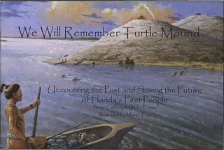
We Will Remember Turtle Mound UCF Childrens Book Beautifully drawn children's book on the history of the Timucuan indians at Turtle Mound.