Info:Max Brewer Bridge: Difference between revisions
From Indian River Lagoon Project
mNo edit summary |
mNo edit summary |
||
| (2 intermediate revisions by the same user not shown) | |||
| Line 2: | Line 2: | ||
|Name=Max Brewer Bridge | |Name=Max Brewer Bridge | ||
|Road=SR406 | |Road=SR406 | ||
|Water=Indian River | |Water=North Indian River | ||
|City=Titusville | |City=Titusville | ||
|County=Brevard | |County=Brevard | ||
|Coordinates=28.61758, -80.80274 | |Coordinates=28.61758,-80.80274 | ||
|Type=Segmental Span | |Type=Segmental Span | ||
|Builder=DRMP | |Builder=DRMP | ||
| Line 19: | Line 19: | ||
|Link3=http://bridgereports.com/1646982 Max Brewer Bridge Inspection Report | |Link3=http://bridgereports.com/1646982 Max Brewer Bridge Inspection Report | ||
|Poster=Admin | |Poster=Admin | ||
| | |Posted=20191202211317 | ||
}} | }} | ||
{{Bridge_Data_Query|where=Number_008|like=700227 }} | |||
Latest revision as of 19:13, January 2, 2021
Max Brewer Bridge | ||||
|---|---|---|---|---|
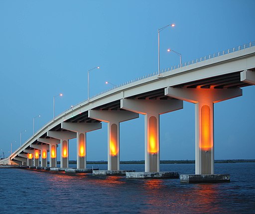
| Completed in 2010, the 3,207' long, 65' high A. Max Brewer Bridge connects the City of Titusville to Merritt Island providing access to the Kennedy Space Center via SR406. Includes a fishing pier and boat ramps on the west side and a 20' observation deck at the crest. This bridge is a good observation site for Kennedy Space Center, when it is closed to vehicle traffic. Article | ||||
| Waterway: North Indian River | Road: SR406 | |||
| City: Titusville | County: Brevard | |||
| Type: Segmental Span | Builder:DRMP | |||
| DOT: 700227 | L: 3,207' | H: 65' | Built: 2010 | |
Location: 28.61758,-80.80274
| ||||
| Number | 700227 |
| Route | 00406 |
| Place | Titusville |
| County | Brevard |
| Features | Indian River |
| Facility | SR-406 |
| Location | SR-406 over Indian River |
| Latitude | 28371291 |
| Longitude | 80475557 |
| Service On Roadway | Highway |
| Service Under Roadway | Waterway |
| Owner | FDOT |
| Built | 2010 |
| Rebuilt | |
| Lanes | 2 |
| Lane Direction | 2 way |
| Direction | |
| Traffic | 4000 |
| Traffic Year | 2016 |
| Future Traffic | 6940 |
| Future Traffic Year | 2038 |
| Length | 978m |
| Width | 17m |
| Clearance | |
| Kind | Prestressed concrete continuous |
| Type | Stringer/Multi-beam/Girder |
| Deck Type | Concrete Cast-in-Place |
| Critical | |
| Inspection Date (mm-yy) | 06-17 |
| Deck | Very Good |
| Superstructure | Good |
| Substructure | Very Good |
| Channel | Banks are protected or well vegetated. River control devices such as spur dikes and embankment protection are not required or are in a stable condition. |
| Culvert | N/A |
| Scour | Bridge foundations determined to be stable for assessed or calculated scour condition. Scour is determined to be within the limits of footing or piles (Example B) by assessment (i.e.,bridge foundations are on rock formations that have been determined to resist scour within the service life of the bridge), by calculations or by installation of properly designed countermeasures |
